
Marine Science News
Why do shark bites seem to be more deadly in Australia than elsewhere?
The first thing to say about shark attack deaths is that they are very rare, with only about two per year in Australia. But still, every year without fail, people die from shark bites, both here and around the world.
According to official statistics, the United States records by far the most unprovoked shark bites – an average of 45 per year over the past decade. However, only 1.3% of these incidents were fatal – 0.6 deaths per year.
Australia records fewer bites than the US (an average of 14 per year), but a much greater proportion of them are deadly: (1.5 per year, or close to 11%). So what is it that (relatively speaking) makes Australia more prone to deadly shark attacks?
Read more: Not just nets: how to stop shark attacks without killing sharks
My new book Shark Attacks: Myths, Misunderstandings and Human Fear addresses this and other questions about sharks, with the aim of dispelling common myths and providing the knowledge needed for decisions made on science rather than fear and emotion.
A perfect storm
In a way, Australia has a “perfect storm” of conditions for serious shark attacks. The first reason is that Australians (and visitors to Australia) love the ocean. Some 85% of Australians live within 50km of the coast, and Australian coastal areas account for the most prominent growth outside of capital cities. Beaches are also favoured recreational destinations in Australia and coastal locations are heavily targeted in tourism, attracting nearly 60% of international tourists.
Next, the sharks themselves. Australia has the world’s highest diversity of sharks and rays, including roughly 180 of the 509 known shark species.
But neither of these factors, even taken together, is enough to explain why deaths are more prevalent in Australia. What we really need to look at is dangerous sharks.
Only 26 shark species have been definitively identified as biting humans without provocation, although the true number is likely to be somewhat higher. Of these 26 species, 22 (85%) are found in Australian waters.
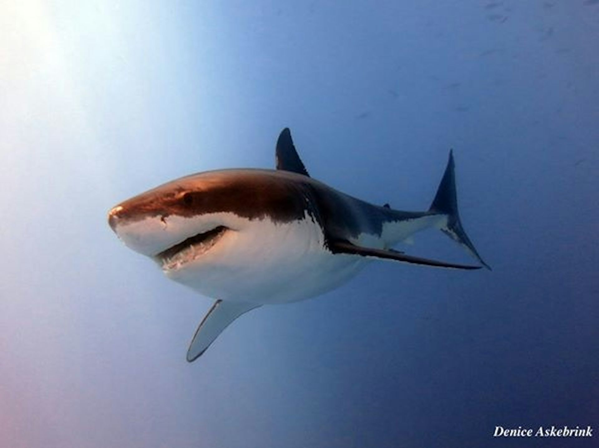
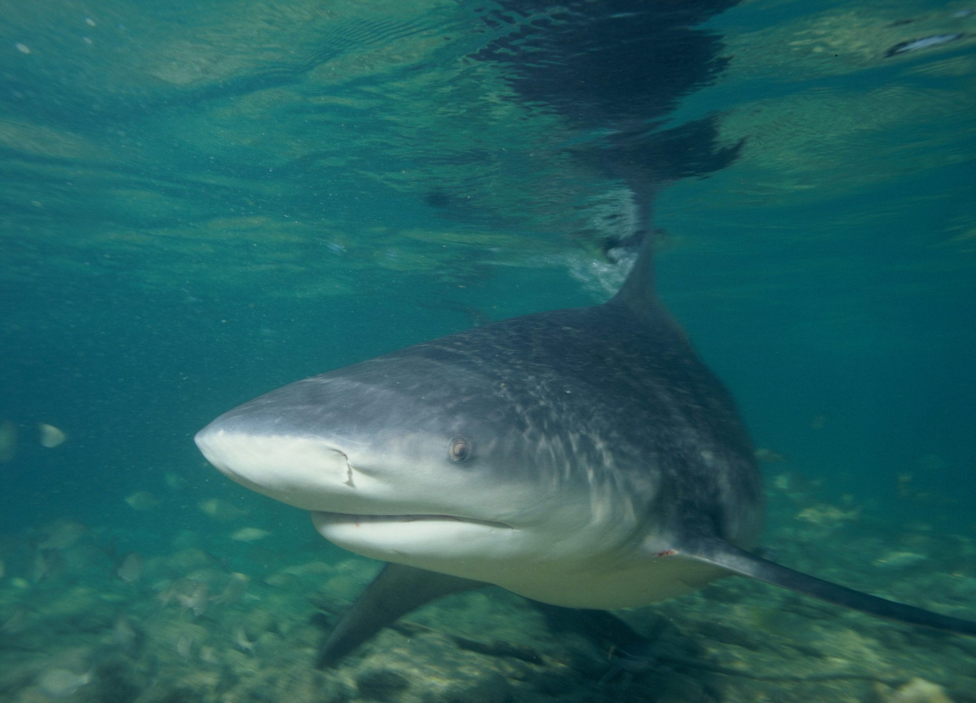
All 11 of the species known to have caused fatal unprovoked bites on humans can be found in Australian waters. And crucially, Australia’s coastal waters are home to all of the “big three” deadly species: white sharks, tiger sharks, and bull sharks.

These species account for all but three of the fatal shark attacks worldwide from 1982-2011. All of the big three species are inquisitive, regularly frequent coastal environments, and are formidably big and strong.
They also have complex, unpredictable behaviour. But despite this difficulty, we can identify factors that make them more likely to swim in areas routinely used by humans.
Warming to it
White sharks have a physiological adaptation that allows them to maintain a vast global distribution, and hence are responsible for the northernmost and southernmost recorded shark bites on humans.
Most fish are ectothermic, or cold-blooded, with body temperatures very close to that of the surrounding water. This restricts their range to places where the water temperature is optimal.
In contrast, white sharks and a few other related species can retain the heat generated by their muscles predominantly during swimming, enabling them to be swift and agile predators even in cold water. They do this with the help of bunches of parallel arteries and veins in their brains, eyes, muscles and stomachs that function as “heat exchangers” between incoming and outgoing blood, allowing them to keep these crucial organs warm.
White sharks are so good at retaining heat that their core body temperature can be up to 14.3℃ above the surrounding water temperature. This allows them to move seasonally up and down Australia’s east and west coasts, presumably following migrating prey species.
Getting salty
Bull sharks, meanwhile, are the only sharks known to withstand wide variations in water salinity. This means they can easily move from salty oceans to brackish estuaries and even travel thousands of kilometres up river systems. As a result they can overlap with human use areas such as canals, estuaries, rivers and even some lakes. One female bull shark was observed making a 4,000km round-trip to give birth in a secluded Madagascan estuary rather than the open ocean.
As a result, most bull sharks found in river systems are juveniles, but these areas may also be home to large, pregnant females who need to eat more prey to sustain themselves. As rivers are often clouded by sediment, there is an increased risk that a human may be mistaken for prey in this low-visibility environment.
Opportunistic tigers
Tiger sharks mainly stay in coastal waters, although they also venture into the open ocean. Their movements are unpredictable, they eat a wide range of prey, are naturally curious and opportunistic, and can be aggressive to humans.
Tiger sharks are clever too – they are thought to use “cognitive maps” to navigate between distant foraging areas, and have hunting ranges that span hundreds of thousands of square kilometres so as to maintain the element of surprise. As a result, tiger sharks’ distribution in Australian waters covers all but the country’s southern coast.

Read more: Finally, a proven way to keep great white sharks at arm’s length
Taken together, it’s clear that Australia’s waters are home to three predators that can pose a real danger, even if only an accidental one, to humans.
But remember that shark attacks are incredibly rare events, and fatal ones even rarer still. There are also lots of tips we can use to minimise the risk of having a negative encounter with a shark.
![]() Don’t swim in murky, turbid or dimly lit
water, as sharks may not be able to see you properly (and you may not be able to see them). Avoid swimming in canals, or far from the shore, or along dropoffs. Swim in designated areas and with
others, and avoid swimming where baitfish (or bait) may be present. And of course, always trust your instincts.
Don’t swim in murky, turbid or dimly lit
water, as sharks may not be able to see you properly (and you may not be able to see them). Avoid swimming in canals, or far from the shore, or along dropoffs. Swim in designated areas and with
others, and avoid swimming where baitfish (or bait) may be present. And of course, always trust your instincts.
Blake Chapman, Adjunct Research Fellow, Science Communicator, The University of Queensland
This article was originally published on The Conversation. Read the original article.
Understanding the feeding role of tiger sharks

Tiger sharks are one of the most successful large predators in the world’s oceans, but studying what they eat has been a challenge for researchers. Historically diet is studied through examining stomach contents, but scientists at the Australian Institute of Marine Science (AIMS) and collaborators are leading the way in understanding more about the feeding habits of sharks from their skin tissue. This allows us to learn about shark diet based on a quick non-lethal approach.
In a recent study, AIMS marine biologists Dr Luciana Ferreira, Dr Michelle Thums, Dr Mark Meekan and co-authors from a number of Australian universities, revealed their findings after examining the tissue samples of 273 tiger sharks from Western Australia to New South Wales and the Great Barrier Reef. Samples of blood and muscle tissue of tiger sharks showed information on the prey, position of individual sharks in the food chain, and even what type of habitat (coastal or offshore, seabed or open water) the animal had been feeding in.
Dr Ferreira said tiger sharks are large mobile animals and to ensure sustainable and resilient populations, we need better data on their feeding and behaviors. “In terms of predators, if we can understand the shark’s motivations and how they are using habitats, we can also understand their function within these habitats,” she said.

Difficulties involved in the direct observation of feeding behaviour of marine megafauna such as tiger sharks, has led to the use of alternative techniques to provide insights into the process of their foraging. One of the most common of these is the analysis of stable isotopes of carbon and nitrogen in their tissues, which can provide information on diet, feeding position in the food chain and interactions among different species, and their migratory movements. “Our analysis of stable isotopes shows that the functional role of tiger sharks in food-webs varied among different marine habitats we sampled along the tropical and temperate coasts of Australia,” Dr Ferreira said.
“Tiger sharks in Shark Bay and Ningaloo Reef in Western Australia, and on the Great Barrier Reef had long-term diets based in seagrass and reef-associated food webs. In these habitats they are focussed on turtles and dugong as prey. “In contrast, when sharks were sampled in more temperate habitats such the waters off New South Wales and southern Queensland, the composition of their tissues reflected a diet based on more pelagic [ocean-going] food webs, and they were focused on large fish. “Tiger sharks occupied roles at the top of food webs at Shark Bay in Western Australia and on the Great Barrier Reef, but not at Ningaloo Reef or off the coast of NSW. “This means the local environment and prey community appear to be the most important determinants of the diet of tiger sharks.” Dr Ferreira said the research confirmed the role of tiger sharks in Australian coastal ecosystems as opportunistic, flexible predators.
The research paper ‘The trophic role of a large marine predator, the tiger shark Galeocerdo cuvier’ is published in Nature Scientific Reports.
9 November 2017, Australian Institute of Marine Science, 2017
El Niño in the Pacific has an impact on dolphins over in Western Australia
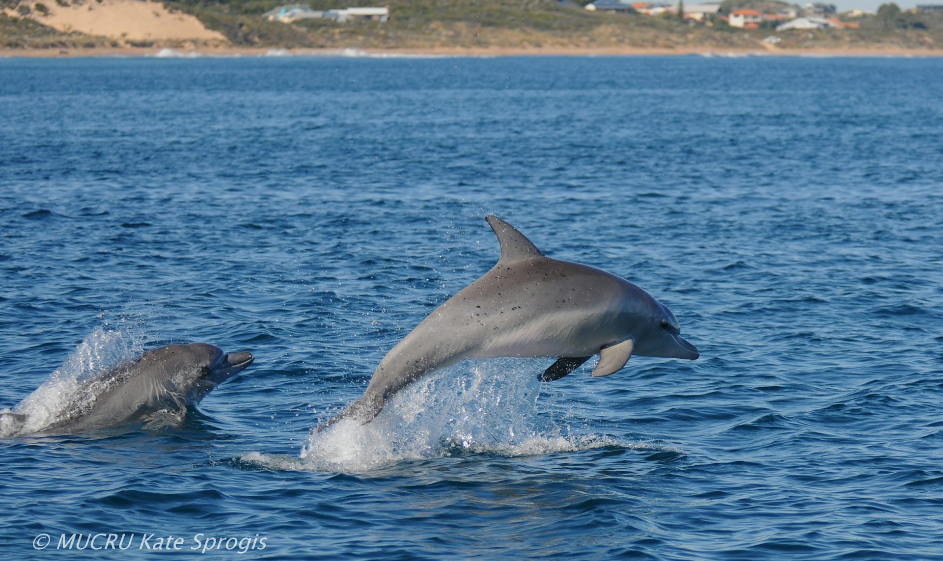
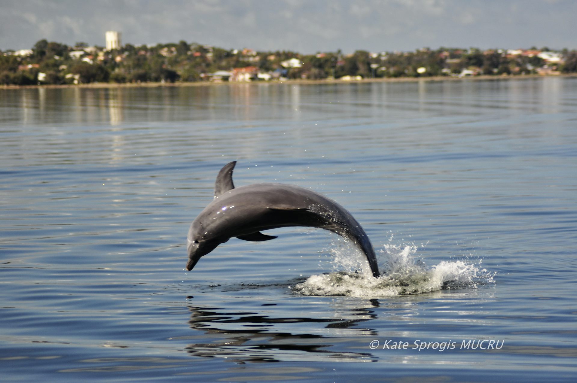
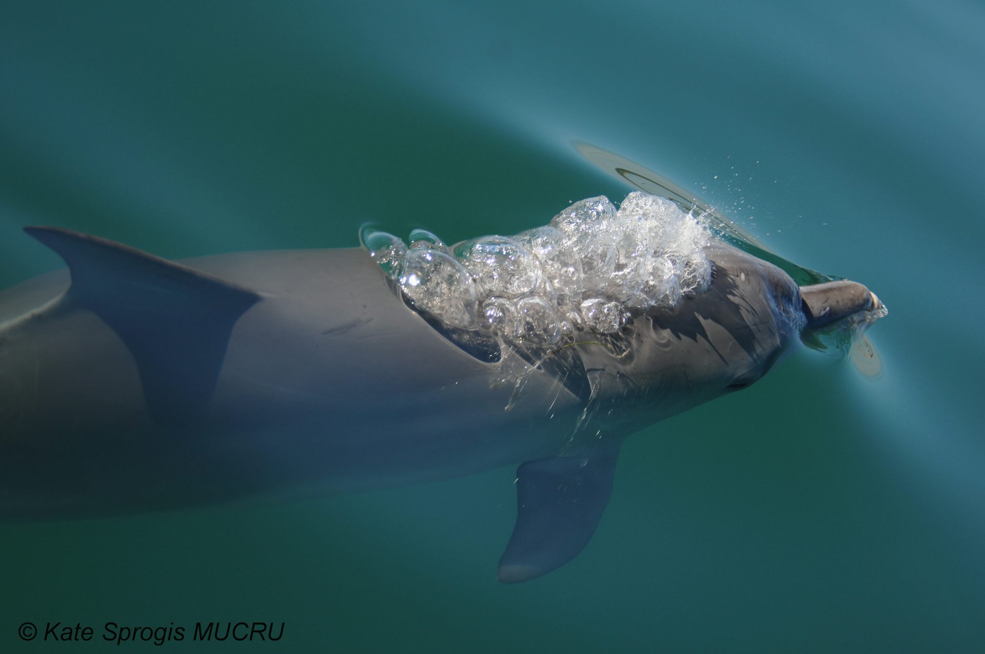
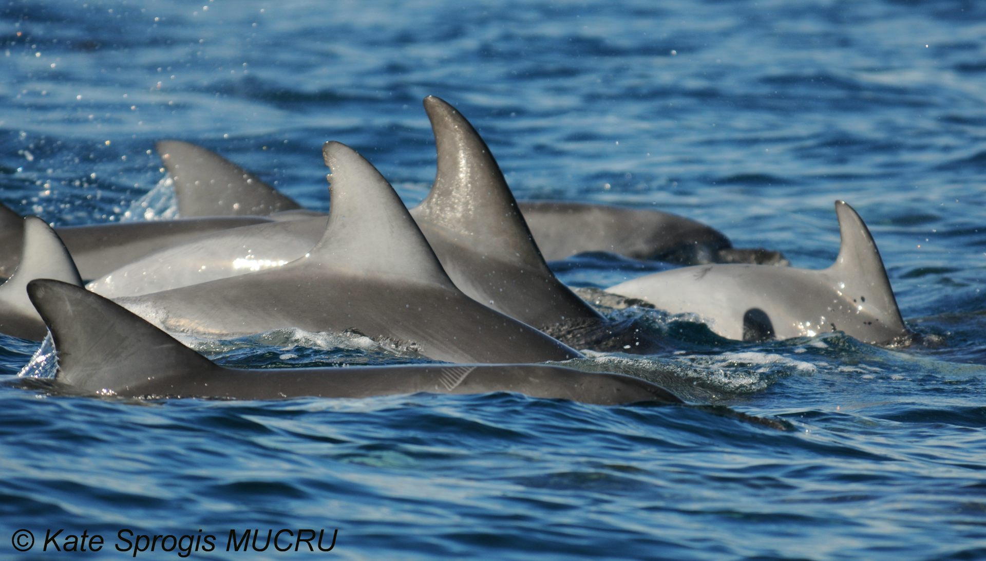
Indo-Pacific bottlenose dolphins (Tursiops aduncus) are a regular sight in the waters around Australia, including the Bunbury area in Western Australia where they attract tourists.
The dolphin population here, about 180km south of Perth, has been studied quite intensively since 2007 by the Murdoch University Cetacean Unit. We know the dolphins here have seasonal patterns of abundance, with highs in summer/autumn (the breeding season) and lows in winter/spring.
But in winter 2009, the dolphin population fell by more than half.
This decrease in numbers in WA could be linked to an El Niño event that originated far away in the Pacific Ocean, we suggest in a paper published today in Global Change Biology. The findings could have implications for future sudden drops in dolphin numbers here and elsewhere.
Read more: Tackling the kraken: unique dolphin strategy delivers dangerous octopus for dinner
A Pacific event
The El Niño Southern Oscillation (ENSO) results from an interaction between the atmosphere and the tropical Pacific Ocean. ENSO periodically fluctuates between three phases: La Niña, Neutral and El Niño.
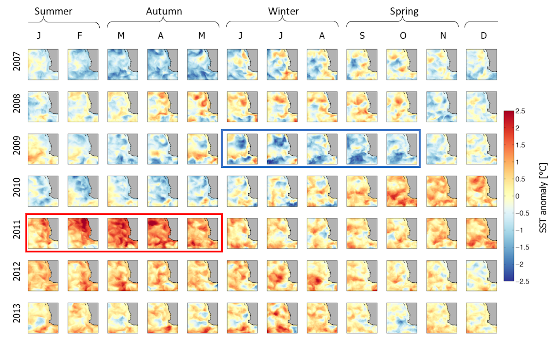
During our study from 2007 to 2013, there were three La Niña events. There was one El Niño event in 2009, with the initial phase in winter being the strongest across Australia.
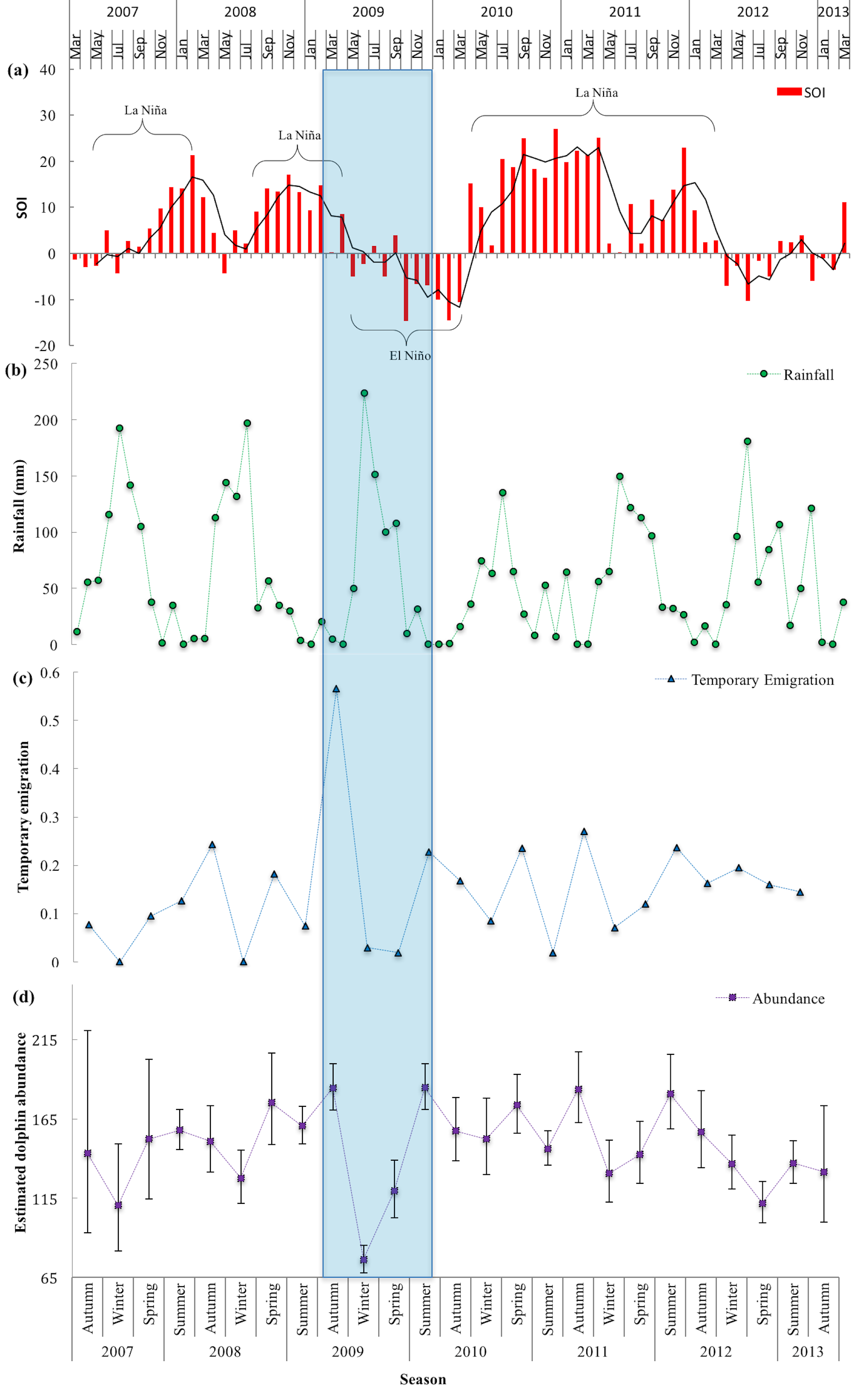
Coupled with El Niño, there was a weakening of the Leeuwin Current, the dominant ocean current off WA. There was also a decrease in sea surface temperature and above average rainfall.
ENSO is known to affect the strength of the south-ward flowing Leeuwin Current.
During La Niña, easterly trade winds pile warm water on the western side of the Pacific Ocean. This westerly flow of warm water across the top of Australia through the Indonesian Throughflow results in a stronger Leeuwin Current.
During El Niño, trade winds weaken or reverse and the pool of warm water in the Pacific Ocean gathers on the eastern side of the Pacific Ocean. This results in a weaker Indonesian Throughflow across the top of Australia and a weakening in strength of the Leeuwin Current.
The strength and variability of the Leeuwin Current coupled with ENSO affects species biology and ecology in WA waters. This includes the distribution of fish species, the transport of rock lobster larvae, the seasonal migration of whale sharks and even seabird breeding success.
The question we asked then was whether ENSO could affect dolphin abundance?
What happened during the El Niño?
These El Niño associated conditions may have affected the distribution of dolphin prey, resulting in the movement of dolphins out of the study area in search of adequate prey elsewhere.
This is similar to what happens for seabirds in WA. During an El Niño event with a weakened Leeuwin Current, the distribution of prey changes around seabird’s breeding colonies resulting in a lower abundance of important prey species, such as salmon.
This in turn negatively impacts seabirds, including a decrease in reproductive output and changes in foraging.
In southwestern Australia, the amount of rainfall is strongly connected to sea surface temperature. When the water temperature in the Indian Ocean decreases, the region receives higher rainfall during winter.
High levels of rainfall contribute to terrestrial runoff and alters freshwater inputs into rivers and estuaries. The changes in salinity influences the distribution and abundance of dolphin prey.
This is particularly the case for the river, estuary, inlet and bay around Bunbury. Rapid changes in salinity during the onset of El Niño may have affected the abundance and distribution of fish species.
In 2009, there was also a peak in strandings of dead bottlenose dolphins in WA (between 1981-2010), but the cause of this remains unknown.
Of these strandings, in southwest Australia, there was a peak in June that coincided with the onset of the 2009 El Niño.
Specifically, in the Swan River, Perth, there were several dolphin deaths, with some resident dolphins that developed fatal skin lesions that were enhanced by the low-salinity waters.
What does all this mean?
Our study is the first to describe the effects of climate variability on a coastal, resident dolphin population.
We suggest that the decline in dolphin abundance during the El Niño event was temporary. The dolphins may have moved out of the study area due to changes in prey availability and/or potentially unfavourable water quality conditions in certain areas (such as the river and estuary).
Read more: Explainer: El Niño and La Niña
Long-term, time-series datasets are required to detect these biological responses to anomalous climate conditions. But few long-term datasets with data collected year-round for cetaceans (whales, dolphins and porpoises) are available because of logistical difficulties and financial costs.
Continued long-term monitoring of dolphin populations is important as climate models provide evidence for the doubling in frequency of extreme El Niño events (from one event every 20 years to one event every ten years) due to global warming.
![]() With a projected global increase in
frequency and intensity of extreme weather events (such as floods, cyclones), coastal dolphins may not only have to contend with increasing coastal human-related activities (vessel disturbance,
entanglement in fishing gear, and coastal development), but also have to adapt to large-scale climatic changes.
With a projected global increase in
frequency and intensity of extreme weather events (such as floods, cyclones), coastal dolphins may not only have to contend with increasing coastal human-related activities (vessel disturbance,
entanglement in fishing gear, and coastal development), but also have to adapt to large-scale climatic changes.
Kate Sprogis, Research associate, Murdoch University; Fredrik Christiansen, Postdoctoral Research Fellow, Murdoch University; Lars Bejder, Professor, Cetacean Research Unit, Murdoch University, Murdoch University, and Moritz Wandres, Oceanographer PhD Student, University of Western Australia
This article was originally published on The Conversation. Read the original article.
9 October 2017
Study uncovers value of shark dive tourism

Shark diving tourism is a growing industry estimated to be worth more than $25.5 million annually to Australia’s regional economy.
A new report has documented the value on marine wildlife tourism, underlining a need for adequate management of shark species to ensure a sustainable dive tourism industry.
A collaboration between the Australian Institute of Marine Science (AIMS), Flinders University, University of Western Australia, and Southern Cross University documented the industry of four major shark viewing industries across the Australian coast.
AIMS marine biologist and co-author of the study Dr Mark Meekan said the research aimed to provide an estimate of the economic value of shark diving tourism across Australia to help inform decisions about how sharks are managed.
Dr Meekan said whale sharks, known as the gentle giants of the sea, were the most popular drawcard for tourists who spent an estimated $11.6 million for the snorkelling experience. “Ecotourism focused on these animals is now a growing and profitable industry, with a focus that not only uses sharks as a renewable resource, but also engages people in their conservation,” he said.
“In Australia, there are four major shark tourism industries, which include snorkelling with whale sharks off Ningaloo Reef in Western Australia, cage diving with white sharks off Port Lincoln in South Australia, diving with grey nurse sharks off the coast of New South Wales and Queensland, and swimming with reef sharks at Osprey Reef in far North Queensland.”
The study surveyed 711 tourist divers over a one year period and documented their expenditure, including accommodation, transport, living costs, and other related activities during divers’ trips. Flinders University Associate Professor Charlie Huveneers, lead author of the study and research leader of the Southern Shark Ecology Group, said the white shark cage-diving industry off Port Lincoln, South Australia, was the second most valuable shark viewing industry contributing $7.8 million in direct costs to the economy in 2013–2014. “On top of costs directly associated with shark viewing, white shark and whale shark tourists spend as much again in additional expenditure in the region,” Assoc Prof Huveneers said.
”We found 83 per cent of the white shark cage-divers would not have visited the Port Lincoln region and spent money there if a cage-diving opportunity had not been available.
“These additional revenues show that the economic value of this type of tourism do not flow solely to the industry, but are also spread across the region where it is hosted, even in countries with developed economies that are not typically considered to have a dependence on tourism for revenue.”
Assoc Prof Huveneers said wildlife tourism was one of the fastest growing sectors of the tourism industry, but the impact to the natural environment must be measured. “This reiterates the importance of adequate management of these industries to ensure sustainable practices, so future generations have the opportunity to view and interact with sharks in the wild in the same way that we currently can,” he said.
Dr Meekan said about half the white shark divers were domestic visitors but the highest percentage of domestic tourists were found in the grey nurse shark-diving industry, at 59 per cent. Most tourists in whale shark snorkelling tours were international tourists (55%) and only 29% were Australian.
Total number of divers at each of the locations during the study from March 2013 to June 2014:
Osprey Reef, far North Queensland, 1, 848 tourist divers (reef sharks)
Neptune Islands, South Australia, 10,236 tourist divers (white sharks)
Ningaloo Reef, Western Australia, 22,124 tourist divers (whale sharks)
The combined total of divers to four locations in South East Queensland (Wolf Rock and Julian Rock), and NSW (Fish Rock and Magic Point) 13,978 tourist divers (grey nurse sharks)
The paper 'The economic value of shark-diving tourism in Australia' has been published in the journal Reviews in Fish Biology and Fisheries.
Original article from Australian Institute of Marine Science (2017)
AIMS 12 September 2017
Australia’s new marine parks plan is a case of the Emperor's new clothes

The federal government’s new draft marine park plans are based on an unsubstantiated premise: that protection of Australia’s ocean wildlife is consistent with activities such as fishing and oil and gas exploration.
Under the proposed plans, there would be no change to the boundaries of existing marine parks, which cover 36% of Commonwealth waters, or almost 2.4 million square kilometres. But many areas inside these boundaries will be rezoned to allow for a range of activities besides conservation.
The plans propose dividing marine parks into three types of zones:
- Green: “National Park Zones” with full conservation protection
- Yellow: “Habitat Protection Zones” where fishing is allowed as long as the seafloor is not harmed
- Blue: “Special Purpose Zones” that allow for specific commercial activities.
Crucially, under the new draft plans, the amount of green zones will be almost halved, from 36% to 20% of the marine park network, whereas yellow zones will almost double from 24% to 43%, compared with when the marine parks were established in 2012.
The government has said that this approach will “allow sustainable activities like commercial fishing while protecting key conservation features”.
But like the courtiers told to admire the Emperor’s non-existent new clothes, we’re being asked to believe something to be true despite strong evidence to the contrary.
The Emperor’s unrobing
The new plans follow on from last year’s release of an independent review, commissioned by the Abbott government after suspending the previous network of marine reserves implemented under Julia Gillard in 2012.
Yet the latest draft plans, which propose to gut the network of green zones, ignore many of the recommendations made in the review, which was itself an erosion of the suspended 2012 plans.
The extent of green zones is crucial, because the science says they are the engine room of conservation. Fully protected marine national parks – with no fishing, no mining, and no oil and gas drilling – deliver far more benefits to biodiversity than other zone types.
The best estimates suggest that 30-40% of the seascape should ideally be fully protected, rather than the 20% proposed under the new plans.
Partially protected areas, such as the yellow zones that allow fishing while protecting the seabed, do not generate conservation benefits equivalent to those of full protection.
While some studies suggest that partial protection is better than nothing, others suggest that these zones offer little to no improvement relative to areas fully open to exploitation.
Environment minister Josh Frydenberg has pointed out that, under the new plans, the total area zoned as either green or yellow will rise from 60% to 63% compared with the 2012 network. But yellow is not the new green. What’s more, yellow zones have similar management costs to green zones, which means that the government is proposing to spend the same amount of money for far inferior protection. And as any decent sex-ed teacher will tell you, partial protection is a risky business.
What do the draft plans mean?
Let’s take a couple of examples, starting with the Coral Sea Marine Park. This is perhaps the most disappointing rollback in the new draft plan. The green zone, which would have been one of the largest fully protected areas on the planet, has been reduced by half to allow for fishing activity in a significantly expanded yellow zone.

This yellow zone would allow the use of pelagic longlines to fish for tuna. This is despite government statistics showing that around 30% of the catch in the Eastern Tuna and Billfish fishery consists of species that are either overexploited or uncertain in their sustainability, and the government’s own risk assessment that found these types of fishing lines are incompatible with conservation.
What this means, in effect, is that the plans to establish a world-class marine park in the Coral Sea will be significantly undermined for the sake of saving commercial tuna fishers A$4.1 million per year, or 0.3% of the total revenue from Australia’s wild-catch fisheries.
Contrast this with the A$6.4 billion generated by the Great Barrier Reef Marine Park in 2015-16, the majority of which comes from non-extractive industries.
This same erosion of protection is also proposed in Western Australia, where the government’s draft plan would reduce green zones by 43% across the largest marine parks in the region.

Again, this is despite clear evidence that the fishing activities occurring in these areas are not compatible with conservation. Such proposals also ignore future pressures such as deep-sea mining.
The overall effect is summarised neatly by Frydenberg’s statement that the government’s plans will:
…increase the total area of the reserves open to fishing from 64% to 80% … (and) make 97% of waters within 100 kilometres of the coast open for recreational fishing.
Building ocean resilience
Science shows that full protection creates resilience by supporting intact ecosystems. Fully protected green zones recover faster from flooding and coral bleaching, have reduced rates of disease, and fend off climate invaders more effectively than areas that are open to fishing.
Green zones also contribute indirectly to the blue economy. They help support fisheries and function as “nurseries” for fish larvae. For commercial fisheries, these sanctuaries are more important than ever in view of the declines in global catches since we hit “peak fish” in 1996.
Of course it is important to balance conservation with sustainable economic use of our oceans. Yet the government’s new draft plan leaves a huge majority of Australia’s waters open to business as usual. It’s a brave Emperor who thinks this will protect our oceans.
![]() So let’s put some real clothes on the
Emperor and create a network of marine protection that supports our blue economy and is backed by science.
So let’s put some real clothes on the
Emperor and create a network of marine protection that supports our blue economy and is backed by science.
Jessica Meeuwig, Professor & Director, Marine Futures Lab, University of Western Australia and David Booth, Professor of Marine Ecology, University of Technology Sydney
This article was originally published on The Conversation. Read the original article.
24 July 2017
Long-term monitoring update to condition of the Great Barrier Reef
Summary
- Over the past 12 months hard coral cover on the Great Barrier Reef declined by about a quarter, bringing average reef-wide coral cover down to 18%.
- These findings are based on broadscale (manta tow) surveys of 68 mainly mid- and outer-shelf reefs to March 2017, and do not yet include the impact of Tropical Cyclone Debbie or the further intense coral bleaching in 2017.
- In general, the impacts of coral bleaching, cyclones and crown-of-thorns starfish outbreaks differ along the length of the Reef.
- In a longer term context, the scale of the coral cover decline in the Northern GBR since 2013 is unprecedented, first due to 2 severe cyclones and then the severe coral bleaching event which began 2016.
- In contrast, due to the proliferation of fast growing coral species and the absence of major disturbances, reefs in the Southern GBR continued to recover during the reporting period.
The AIMS Long-term Monitoring Program has released an update on the condition of the Great Barrier Reef (GBR) based on survey data gathered across the entire GBR over the last 32 years. The update, which assesses data captured up to February 2017, describes a system under considerable pressure.
Following on from an AIMS publication in 2012, which described a 27-year decline in coral cover on the Reef, and last year’s update, today’s update shows that average hard coral cover (the most common indicator of reef health) across the entire system declined further during 2016, but the magnitude and trajectory of change varied between the Northern, Central and Southern regions.
Click here to read the full update.
“The Great Barrier Reef is a large, dynamic and important ecosystem, so it is essential that we continually monitor its condition and trends, and update our understanding of the reef’s current health in a broader context”, says Dr Britta Schaffelke, Program Leader for the AIMS ‘Healthy and Resilient GBR’ Program.
“These data show that the impacts of disturbances such as coral bleaching, crown-of-thorns starfish and cyclones vary along the length of the Reef. The decline in coral cover due to severe disturbances over the past two years is quite concerning.”
Dr Hugh Sweatman, AIMS Research Scientist and head of the monitoring team explains, “Our most recent data show that in the Northern region, coral cover is less than half of what is was in 2011, which is unprecedented for the region in the last 30+ years.
“This decline is largely due to severe coral bleaching event that caused significant mortality in 2016, in combination with 2 severe cyclones and continued crown-of-thorns outbreaks.
“The Central region was experiencing a general increase in coral cover until bleaching reduced this in 2016. Coral cover in the Southern region continues to increase from low levels in 2009.”


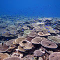


The Southern GBR region during 2016/2017. Coral cover on reefs of the Southern GBR has recovered remarkably since it was obliterated by storms in 2008 and then Cyclone Hamish in 2009. The reef slopes of Lady Musgrave Reef and Erskine Reef, pictured here, are now covered in tabulate and branching Acropora sp. corals.
The update includes information taken from the extensive surveys taken over 2016 and into early 2017, but does not include data after the 2017 severe bleaching event, or Tropical Cyclone Debbie. This information will be included in future updates.
Long-term outlook for the Great Barrier Reef
The researchers highlight that it is difficult to predict the recovery of the Great Barrier Reef. “Despite the fact that we have over 30 years of information from the Program, we are only now starting to have data gathered over a sufficiently long period of time to allow us to understand the reef recovery process under a changing climate,” says Dr Schaffelke.
“Recent analysis of this long-term data set shows that recovery can be severely hampered by impacts associated with climate change, particularly increasing sea temperatures.”
A recent AIMS study indicated that recovery after a major heat-stress event in 2002 on the GBR was slowed, compared to previous recovery periods, and that affected reefs suffered high rates of coral disease. A separate AIMS study on the effects of cyclones concluded that, while recovery can be strong on some reefs, the projected increases in intensity of cyclones as a result of climate change could make it more difficult for reefs to recuperate.
Read the update in full here.
AIMS’ Long-term Monitoring Program is the longest, most comprehensive source of information on the health of corals for the Great Barrier Reef.
June 1 2017
Original article from Australian Institute of Marine Science (2017)
Feeling helpless about the Great Barrier Reef? Here’s one way you can help
It is easy to feel overwhelmed when confronted with reports of the second mass bleaching event on the Great Barrier Reef in
as many years. But there is a way to help scientists monitor the reef’s condition. ![]()
CoralWatch is a citizen science program started at The University of Queensland 15 years ago, with two main aims: to monitor the environment on a vast scale, and to help people get informed about marine science.
These goals come together with coral health monitoring. Divers, snorkelers or people walking around reef areas during low tides can send us crucial information about coral bleaching, helping us to build detailed pictures of the health of different reefs.
Participants can use a colour chart, backed up through the CoralWatch app or website, to measure accurately the colour and type of coral they see. The chart covers 75% of known corals, and can be used with no prior training.
We also ask people to enter the type of coral (branching, boulder, plate or soft), the location, and the weather. This allows scientists to identify the location and extent of any problems quickly (and is an excellent way to learn more about our reefs).
In fact, you don’t even have to go to a reef to participate and discover through CoralWatch; we have classroom and virtual reef systems, and just talking the problem through can help.

The graphs shown below are samples of CoralWatch data from the northern and southern reef during 2016’s catastrophic mass bleaching event, while the pair of graphs further down the page show data from just a few days ago at Lady Elliot Island and the very remote North Mariana Islands in the West pacific.
The Heron Island graph shows a healthy reef, as the southern areas of the reef escaped the worst of the bleaching last year. In contrast, Monsoon Reef (which lies off Port Douglas) and many others in the north bleached badly, or in some cases simply died.
Scores averaging between four and six are normal and represent good levels of symbiotic algae, which generate nutrients for the coral. Scores below three signify that coral is in distress.
The impact of this year’s mass bleaching is still being quantified. However, reefs in the middle section and far south of the reef – such as Lady Elliot Island – are now showing varying degrees of bleaching, from light to severe. Many of the remaining corals in the north are also showing signs of bleaching again.
What seems certain is that we will lose many more corals, along with the fish and invertebrate life they support, again this year.
The results for the North Mariana Islands, from a CoralWatch survey conducted last week, shows mid-level coral bleaching and demonstrates that even very remote reefs are not climate-proof.
Australians increasingly believe the government needs to act on climate change, and some of this change in opinion is likely fuelled by continued reports of coral bleaching.
CoralWatch doesn’t only help build a detailed picture of reef health. Like other citizen science projects, such as Reef Check, it can help speed up our fatally slow response to climate change. There are three key benefits.
First, we need to improve mutual understanding between scientists and the public. The CoralWatch mantra is: tell me and I’ll forget; teach me and I may remember; involve me and I’ll learn. Citizen science is a natural fit for everyone, no matter your level of education or knowledge.
Children are the citizens of the future, and helping them to understand their changing world is a moral and social imperative. CoralWatch works closely with schools and groups like the Marine Teachers Association of Queensland, and is used in more than 75 countries worldwide.
Second, we need to encourage lifestyle change. Many people, as they become more engaged in citizen science, will naturally adopt more environmentally friendly habits. Getting involved in protecting the Great Barrier Reef – and other citizen science projects – can be a great dose of perspective on our place in the natural world.
However, as personally rewarding as they can be, individual lifestyle choices alone won’t deliver the rapid and widespread change we need to save our reefs. That’s why we need to bridge the disconnect between what most of Australia wants and the politicians who ultimately have the power to fast-track change. Citizen scientists are also informed voters and consumers, who can demand better policies from companies and governments.
The future of the Great Barrier Reef is in the hands of Australians, and it will take all of us to preserve it for our children.
Justin Marshall, ARC Laureate Fellow, The University of Queensland; Chris Roelfsema, Research Fellow (Coastal and Marine), The University of Queensland, and Diana Kleine, Coral Watch Project Manager, The University of Queensland
This article was originally published on The Conversation. Read the original article.
April 12 2017
Exceptional fish diversity found on Australia’s north-west oceanic shoals
Scientists have found exceptionally diverse and abundant coral-reef fish communities at submerged oceanic shoals near Ashmore Reef some 400 kilometres off north-western Australia.
The north-west oceanic shoals - natural banks that rise from the seabed, in this case from depths of 200 m up to within 15─50 m of the surface - were found to support the highest fish diversity reported globally for deeper ‘mesophotic’ or middle light level coral reefs (20─80 metre depth) and may support the resilience of shallower coral reef communities.
The study of nine oceanic shoals in the Timor Sea was led by the Australian Institute of Marine Science (AIMS) and reported recently in Coral Reefs.

“Traditionally scientists and managers have focused on understanding threats to shallow coral reef communities,” says Dr Cordelia Moore, a joint research associate from Curtin University and AIMS. “Deeper reefs beyond the reach of SCUBA-based surveys are poorly studied. Our survey used remote monitoring technologies including multibeam acoustics, photography, towed video, remotely operated vehicles and baited remote underwater systems. We found 341 species of fish from 47 families, including 10 shark, five ray and two sea snake species. The fish communities were 1.4 times as diverse and almost twice as abundant as those on similar deeper coral reefs on the Great Barrier Reef.”
The relatively clear waters in the study region allow fauna such as hard corals and macroalgae to grow in depths of up to 60─70 m, supporting diversity similar to shallow reef systems. The fishes may also benefit from enhanced productivity driven by local upwelling and interacting currents. “Characterising these deeper coral-reef communities is critical because mesophotic reefs may provide a unique contribution to biodiversity as well as potentially enhancing the connectivity and resilience of surrounding shallow reefs,” Dr Moore says.
While progress has been made understanding the connectivity within and between coral reefs, the degree of connectivity between shallow and deep coral reef populations is largely unknown. Deeper reefs may act as important refugia, providing a source of larvae, juveniles or adults, to replenish more exposed shallow-water reefs after impacts such as coral bleaching, storms and cyclones, fishing pressure and warming events. This is especially important to understand in regions such as north-western Australia, which is experiencing increasing pressures from human activities such as fishing and petroleum industries.
“Currently, 30% of north-east Australia’s mesophotic reefs are within no-take management zones of the Great Barrier Reef. In contrast, just 1.3% of Australia's north-west oceanic shoals are in designated no-take areas,” Dr Moore says. “Now that we know these habitats support fish biodiversity of global significance, ensuring we understand and manage these deeper reefs is critical.”
The north-west oceanic shoals are of conservation interest at both a regional and global scale. They support many species of conservation interest including the humphead wrasse, greater hammerhead and various sharks, rays and groupers.
Australia’s north-west is one of the country’s most economically significant marine regions, producing most of Australia’s domestic and exported oil and gas. It also has high-value ecological habitats supporting a range of protected species such as dugong, turtle and whale sharks. The need for baseline ecological data for this region was highlighted by the 2009 uncontrolled release from the Montara wellhead platform, which triggered monitoring of key ecological communities to ensure the protection and sustainable management of natural and economic values into the future.
March 23 2017
Original article from Australian Institute of Marine Science (2017)
More intense cyclones pose threat to the world’s coral reefs
In the wake of the Great Barrier Reef’s most intense coral bleaching event, researchers at the Australian Institute of Marine Science (AIMS) report that predicted increases in the intensity of tropical cyclones due to climate change could greatly accelerate coral reef degradation and make it far more difficult for reefs to bounce back from disturbances.
Research published today in Global Change Biology investigated whether predicted increases in cyclone intensity might change the nature of coral reefs. AIMS scientists used the world’s largest coral reef ecosystem, the Great Barrier Reef, as a test case to understand what lies ahead for coral reefs.
A team of researchers led by AIMS scientist, Alistair Cheal, first assessed the ecological impacts to the Reef from cyclones, based on multiple data sets collected from the region. The Institute’s Long-term Monitoring Program contributed crucial broad-scale field data from as far back as 1996, including data captured after recent severe cyclone events (Hamish in 2009, Yasi in 2011 and Ita in 2014). “Here at AIMS, we have been closely monitoring reefs along the Great Barrier Reef for over 20 years through the Long-term Monitoring Program. An analysis of the data collected from outer reefs indicates that a recent spate of unusually intense cyclones caused record destruction of corals and great loss of fishes over >1000 km,” stated Mr Cheal, the study’s lead author.
Using modelling tools, the data was then contextualised in terms of future climate-driven threats based on published predictions for increasing cyclone intensity. The scenarios yielded grim consequences for reefs.
“What we found was that the return time of cyclone sequences likely to cause extreme and widespread losses of corals and fishes could increase from hundreds of years, to once every 25 years within this century. This presents a real threat to the status and recovery of coral reef ecosystems,” Mr Cheal concluded.
The implications extend beyond the projected coral and fish losses through associated decreases in biodiversity, increased vulnerability of coral reefs to long-term degradation and associated flow-on effects to social and economic services.
The paper: “The threat to coral reefs from more intense cyclones under climate change” by Alistair J. Cheal, M. Aaron MacNeil, Michael J. Emslie and Hugh Sweatman is available online today.
February 1 2017
Original article from Australian Institute of Marine Science (2017)
Five ways to reduce your chances of encountering a shark this summer
If the thought of going into the ocean this summer fills you with trepidation, here are five things you can do to reduce your risk of encountering a shark.
1. SWIM CLOSE TO SHORE
A WA Department of Fisheries report found that of the 26 shark attacks in the State between 1991 and September 2011, only one was within 30m of the shore.
Two-thirds of the attacks were more than 200m offshore, and SCUBA divers and snorkelers made up almost half of shark attack victims. Only three of the attacks were on swimmers.
2. ENJOY THE WARMER WATER
White sharks prefer cooler waters and two-thirds of the attacks in WA in the 20 years to 2011 occurred in water temperatures below 200C. Only one was in waters above 220C.
This preference for cooler water plays out in statistics showing there is a higher rate of attacks off the southern half of the WA coast.
More attacks also happen in winter and spring rather than summer and autumn, despite more people being in the water in warmer weather.
3. STAY IN THE SHALLOWS
And by shallows, we mean where the water is less than 5m deep. More than this and your risk of running into a shark increases.
4. WEAR A SHARK SHIELD
For a long time, the jury was out on these electronic shark repellents but UWA-led research has delivered a result that will be music to ocean lovers’ ears—Shark Shields do help to repel white sharks.
The study found the Shark Shield produced an effective deterrent field of about 1.3m from the devices electrodes.
Shark Shields prevented sharks interacting with a bait 10 out of 10 times on an animal’s first approach, and nine out of 10 times on the second approach.
With models starting at $600 a pop, the device is not for everyone.
But for divers and others with good reason to ignore the first three avoidance strategies, a Shark Shield might be worth considering.
5. AVOID SEAL OR SEA LION COLONIES
Finally, the Fisheries research was unable to rule out proximity to seal and sea lion colonies as a factor in shark attacks.
While the majority of attacks occurred more than 10km from a colony, the study found this may reflect relatively low levels of human activity in these areas.
It concluded it remains plausible that there is an increased risk of attack near seal and sea lion colonies.
This article was originally published on Particle. Read the original article.
28 January 2017
Marine Science News
When a beach walk feels like grief: disasters like SA’s algal bloom cut us off from nature when we need it most
As oceans warm, tropical fish are moving south. New friendships may be helping them survive
Jaws at 50: how a single movie changed our perception of white sharks forever
The ocean can look deceptively calm – until it isn’t. Here’s what ‘hazardous surf’ really means
Marine Science facts
The vampire squid gets its name not because it has a taste for blood but from the dark skin on its arms that makes it look like it’s wearing a Dracula-esque cape?
The oceans provide 99% of the living space on the planet containing 50-80% of all life.
The Oceans cover 70% of the earths suface
The deepest part of the ocean is called the Mariana Trench, which is around 7 miles deep and is located in the South Pacific Ocean.
The water pressure at the bottom of the Mariana Trench is eight tons per square inch. This means the pressure there is enough to crush you.
The largest mountain range is found underwater and is called the Mid-Oceanic Ridge that is around 65,000 kilometres long.
Sponges are older than dinosaurs.
Half the Oxygen we breath is produced in the Ocean.
Irukandji jelly fish, with just a brush of venom leaves almost no mark. But after about a half hour you develop Irukandji syndrome, a debilitating mix of nausea, vomiting, severe pain, difficulty breathing, drenching sweating and sense of impending doom. You get so sick that your biggest worry is that you’re not going to die.
The most remote point in the oceans is called Point Nemo.
The Pacific, Atlantic, and Indian oceans are known as the three major oceans.