It’s been 50 years since Steven Spielberg’s movie Jaws first cast a terrifying shadow across our screens.
At a low point during production, Spielberg worried he’d only ever be known for big fish story”. The film, however, did not tank.
Jaws broke box office records and became the highest-grossing movie at the time, only surpassed by the first Star Wars released two years later in 1977.
A combination of mass advertising, familiar “hero” tropes and old-school showmanship launched Jaws as the first modern blockbuster.
Hollywood, and our relationship to oceans and the sharks within them, would never be the same.
In Peter Benchley’s 1974 novel that Jaws is based on, the shark is 6 metres long. For added screen excitement, in the movie it grew to a whopping 7.6 metres.
However, that’s unrealistically large.
The average size of a mature great white Carcharodon carcharias (also known as the white shark) is between 4.6 and 4.9 metres for female sharks and up to 4 metres for male sharks.
The largest recorded living specimens peak at about 6 metres, with one monster specimen caught in Cuba in 1945 reaching 6.4 metres.
Earth’s oceans have seen bigger predatory sharks in the past. The biggest one of all time was the megalodon (Otodus megalodon) which lived from 23 to 3 million years ago, and
may have been up to 24 metres in length. However, it looked nothing like the modern white shark.
That means it ate just about anything, but especially liked whales and marine mammals.
But white sharks are not directly related to the megalodon, whose lineage began with a shark called Cretalamna
during the age of dinosaurs about 100 million years ago.
By contrast, the white shark lineage began with an ancient mako shark, Carcharodon hastalis. It was 7 to 8 metres long and had large, similarly shaped teeth to the modern white shark
but lacking serrated edges.
A fossil intermediate species, Carcharodon hubbelli shows the transition over time from weakly
serrated to strongly serrated teeth.
White shark fossil species. Left, the serrated fossil tooth teeth of the extant white shark; right, a similarly shaped unserrated tooth of the extinct giant mako
shark which gave rise to white sharks.John Long, CC
BY
How did Jaws affect white shark populations?
Last year, the International Shark Attack File reported 47 unprovoked shark bites to humans worldwide,
resulting in seven fatalities. This was well below the previous ten-year average of 70 bites
per year; your chances of getting bitten by a shark are extremely rare.
Following the movies that made up the Jaws franchise, there was an increase in hunting and killing sharks – with a particular focus on
great white sharks that were already going into a decline due to overfishing, trophy hunting and lethal control programs.
When Jaws first aired, scientists didn’t know how long sharks took to reproduce, or how many offspring a white shark could have each year. We now know it takes about 26 years for a male and
33 years for a female to sexually mature before they can start having pups.
Now that we know just how slow they are to breed, it’s clear it will take many decades to reestablish the “pre-Jaws” population of white sharks – important apex predators in the marine ecosystem.
Charlie Huveneers from Flinders University about to take a tissue sample for research on white sharks. There is still a lot we don’t know about their biology.Andrew Fox, Adelaide, CC BY
This classification means if we don’t change the current living conditions for white sharks, including impacts caused by human activities such as commercial fishing, and the impacts of
climate change and ocean pollution, they will continue to decline and eventually could go extinct.
Currently, white sharks are protected in several countries and form the basis for an important tourist industry in Australia, South Africa, western United States and most recently Nova
Scotia, Canada.
These sharks are iconic apex predators that fascinate people. One of us (John) went cage diving with them recently off the Neptune Islands of South Australia and can attest to how
breathtaking it is to watch them in their natural environment.
In terms of economic impact, they are worth far more alive than dead.
White sharks are a growing tourism draw in several countries.Andrew Fox, Adelaide, CC BY
There’s still much we don’t know about white sharks
The complete white shark genome was first published only in 2019. It has 4.63 billion base pairs, making it much larger than
the human genome (3.2 billion base pairs).
The genome revealed some surprising things, like how white sharks show strong molecular adaptations for wound-healing processes, and a suite of “genome stability” genes – those used in DNA
repair or DNA damage response.
The transcriptome (or sum total of the messenger RNA) of the white shark showed greater similarity to the human
transcriptome than to that of other fishes. This hints that “unexpressed genes” in the shark could one day play a role in uncovering genetic pathways for potential cures in human diseases.
Jaws and its sequels certainly brought white sharks to the attention (and nightmares) of humans, with devastating impacts on how we treated them as a species.
Our relationship with white sharks reflects our
relationship with nature more broadly – a feared antagonist within the current capitalist paradigm; an enemy to be tamed, contained or consumed.
As we learn more of the peril and potential of these remarkable creatures, we can learn how to live with them, to see beyond our fears and value their role within our delicate ocean
ecosystems.
John Long, Strategic Professor in Palaeontology, Flinders University and Heather L.
Robinson, Research Associate in Cultural Studies. "Beyond the Books: Culture, value, and why libraries matter" will be published late 2024 through Wakefield Press., Flinders University
The mission of our Shark Defence Campaign is to defend, conserve and protect sharks in order to maintain a healthy ocean.
Around the world, sharks are threatened by many human activities including finning, fishing bycatch, commercial fishing, habitat degradation, climate change and government-endorsed control and
culling programs.
On Australian shores, our Shark Defence Campaign continues to shed much-needed light on the destructive nature of state-sanctioned shark "control" programs through investigation, documentation
and publication. By bringing our message to the Australian public, we are mobilising support for the long-term protection of sharks under Australia’s environment laws.
Using our small boat the Grey Nurse, our campaign actively monitors and reports on shark nets and drumlines in Queensland and New South Wales, acting as a vocal advocate for their
removal.
Marine Worm Offers Clues About Our Evolutionary Past
Platynereis dumerilii are marine worms found across the European coasts. The males (left), have a frontal part with white sperm and a red rear due to blood vessels while the females (right) are initially transparent and acquire a yellow colour.
EMBL researchers study Platynereis dumerilii, a worm that retains many features of ancient species, aiming to discover mechanisms of evolution
After more than 500 million years of existence as a species, the worm Platynereis dumerilii still retains some ancient features that most other animals have moved on from over evolutionary time.
Yet, this species has been able to survive and adapt to a variety of environments.
Scientists in Detlev Arendt's group at EMBL Heidelberg have tracked this marine worm over time and space, in a quest to learn the many lessons it offers about evolution. They recently
took advantage of EMBL's Traversing European Coastlines (TREC) project to broaden their research perspective, resulting in both interesting science and some incredible
stories. cientists in Detlev Arendt's group at EMBL Heidelberg have tracked this marine worm over time and space, in a quest to learn the many lessons it offers about evolution.
They recently took advantage of EMBL's Traversing European Coastlines (TREC) project to broaden their research perspective, resulting in both interesting science and some incredible
stories.
"We don't know which parts are new and which are old in us humans," said Phil Oel, Field Expedition scientist in the Arendt Group. "Since we can't time travel, Platynereis offers a good path
backwards to compare and contrast. We can identify traits still there and infer basic traits - what the original ancestors looked like, so to speak."
In other words, the scientists hope to uncover the species's missing biological history. For example, many brain parts and functions in these worms have retained relatively ancient forms, in
contrast to other animals that have more drastically updated their brains to suit complex needs. This is what makes Platynereis dumerilii special.
Arendt Group's researchers joined the TREC expedition and collected Platynereis worms across European coasts. During the journey, Oel, Gerber, and Witte learnt how to adapt laboratory protocols
to field sampling. Credit: Philip Oel and Patric Mueller/EMBL When the EMBL-led TREC expedition started its field sampling phase in early 2023, it offered the researchers an opportunity to gather
Platynereis from a variety of places along Europe's coasts. By collecting and comparing Platynereis from different locations, the scientists could investigate how the worm populations evolved in
different habitats and conditions.
The main challenge, however, came from the worm's unique mating ritual: a beautiful dance following the lunar cycle. On specific nights, female and male worms sense the presence of each other and
begin swimming in circles, during which the eggs and sperm are released into the water and eggs get fertilised. Capturing these events can be quite tricky, resulting in several unsuccessful
sampling missions.
Arendt Group's researchers joined the TREC expedition and collected Platynereis worms across European coasts. During the journey, Oel, Gerber, and Witte learnt how to adapt laboratory protocols to field sampling. Credit: Philip Oel and Patric Mueller/EMBL
Finally, after several night shifts, the researchers were able to catch Platynereis worms right before mating. Afterwards, the worms were placed in a little ocean on the boat - a simple glass of
water - in which the worms could mate. At this point, the clock stops for the worms since their lifespan comes to an end after releasing the sperm and eggs. In contrast, the clock starts running
for scientists who are interested in studying the progeny at different ages.
"TREC allowed us to study the microevolution of Platynereis and understand how the conditions close to the North and Baltic sea challenged the population compared to the Mediterranean sea, for
example," Gerber said.
Broadening the research scope
Phil Oel, Tobias Gerber, and Victoria Witte, members of the Arendt group at EMBL Heidelberg are studying how Platynereis dumerilii adapts to different environments, investigating possible mechanisms of evolution. Credit: Kinga Lubowiecka/EMBL
When the EMBL-led TREC expedition started its field sampling phase in early 2023, it offered the researchers an opportunity to gather Platynereis from a variety of places along Europe's coasts.
By collecting and comparing Platynereis from different locations, the scientists could investigate how the worm populations evolved in different habitats and conditions.
The main challenge, however, came from the worm's unique mating ritual: a beautiful dance following the lunar cycle. On specific nights, female and male worms sense the presence of each other and
begin swimming in circles, during which the eggs and sperm are released into the water and eggs get fertilised. Capturing these events can be quite tricky, resulting in several unsuccessful
sampling missions.
Using tiny worms to study nervous system evolution
Oel and colleagues collected Platynereis during the night, since this is when these worms come to the water surface to mate. After several unsuccessful night shifts, the researchers were finally able to catch them! Credit: Patric Mueller/EMBL
The size of this species also determines the type of analyses that scientists can do. Gerber's postdoctoral work has him comparing genes expressed in individual cells from across the whole
organism, a technique called single-cell RNA sequencing. "I study the worms at exactly six days of age since they are already tiny worms by then, equipped with the main organs and body parts that
will be maintained until their adult age," he said. At six days of age, the worms are only a few micrometres long (one micrometre being about one-hundredth the thickness of human hair). This
allows Gerber to profile all cell types across the whole worm body simultaneously. Witte, on the other hand, is interested in how the Platynereis nervous system evolves. Her PhD project
looks at cell types present in the worm's brain to get a better fundamental understanding of them and also to potentially compare them to species that are evolutionarily related.
"During my first week at EMBL, I travelled to Villefranche-sur-Mer, close to Nice in France, to join TREC scientists and start collecting Platynereis that were already around one year of age,"
Witte said. "At this time, the worms have specific behaviours and a capacity to learn, so we wanted to know how their brains adapted to different environments encountered at the Mediterranean
versus the North sea."
Both Gerber's and Witte's research projects will help build the first atlas at cellular resolution for a whole Platynereis animal, especially for the nervous system, including early development
and differentiation stages. This work will allow, in the future, not only to select a cell anywhere in the worm body and know what genes that cell expresses but also the other way around:
discover which cell expresses a specific group of genes. These discoveries, when merged with evolutionary biology studies, will make it possible to determine, for example, which cells are
evolutionarily old or new in the worms' brains.
efore TREC, the scientists mostly did lab-controlled temporal evolutionary studies where they grew worms in the lab and studied different stages over time. "TREC made spatial evolution studies
possible," Oel said. "After collecting samples in different locations, we can now merge both datasets and characterise Platynereis across time and space."
Oel's own research looks at photoreceptors. "They are little cells that can detect light and then send this information to the brain," he explained. "Platynereis need these cells. For example,
they help indicate when the worms are too close to the sea surface, where they might be eaten by larger animals, and should therefore swim into deeper waters."
During evolution, cells can change from one type to another. By analysing how photoreceptors in Platynereis have evolved across time and space, Oel is trying to understand how organisms make new
kinds of cells. REC's sampling phase ended this summer, and now the three scientists are ready to use the collected samples to construct a complete story of Platynereis dumerilli evolution.
"With the work of Victoria, Phil, and Tobias, we have now built new fantastic resources that enable us to explore the nervous system of Platynereis at the cellular level," said Detlev Arendt,
EMBL Group Leader. "From this, we expect many more exciting insights into the evolution of the nervous system. This will be regarding both the origin of nervous systems and also their capacity to
adapt to changing conditions, such as the challenges resulting from climate change."
Philip Oel's research is focused on specific cell types present on Platynereis - the photoreceptors. By understanding their functions in this worm, the scientist can infer how new cell types form in organisms. Credit: Kinga Lubowiecka/EMBL
Offshore oil and gas infrastructure brings localised, but limited regional benefits for marine organisms
Main image: Jewel anemones cover an underwater section of an oil and gas platform. Image: AIMS
New research led by the Australian Institute of Marine Science (AIMS) in collaboration with Deakin University and ORCAS Consulting found offshore oil and gas infrastructure plays a minor role in
maintaining regional populations of marine life in north-west and south-east Australia.
In two journal articles, researchers found that the presence, partial, or full removal of decommissioned oil and gas infrastructure in the Bass Strait, between Tasmania and Victoria, and the
north-west shelf of Australia would likely have a low impact on the dispersal processes and long-term persistence of several fish and bottom dwelling species.
The localised benefits to fish and bottom-dwelling invertebrate species supported by these structures may help explain the abundance and diversity of marine life often observed around them.
Many marine organisms start out life as larvae, and these larvae rarely remain in their original habitat. They often travel or disperse via oceanic currents before arriving at suitable habitat,
near or far, where they can settle, mature and reproduce. This process is known as connectivity and is important because it helps marine populations to maintain genetic variability and viability
into the future.
Marine life, including sponges, butterfly perch and bream pictured on and around a pipeline. Image: AIMS
AIMS principal research scientist Dr Di McLean, who was a co-author on one of the papers, said that as more oil and gas structures cease functioning and require decommissioning, science
addressing concerns around their impact and removal is becoming ever more critical.
“There is evidence that oil and gas structures can increase the local abundance and diversity of marine organisms, particularly in seascapes where natural habitats are scarce,” said Dr
McLean.
“However, one of the most significant knowledge gaps and priorities globally is the need to understand how offshore oil and gas infrastructure influences regional processes such
as connectivity and dispersal of marine organisms – this is where our research comes in.”
AIMS principal research scientist Dr Eric Treml, senior author on both papers, added: “These new findings suggest that if structures like platforms are removed, there may be little regional
impact on how the larvae of marine organisms disperse to reach new habitats and how marine populations will be sustained.”
The Bass Strait study found that oil and gas platforms play a minor role in supporting the long-term health and survival of the five representative species (three rocky reef fish and two
invertebrates) studied, but subsea pipelines appear to facilitate important dispersal processes in their early life stages.
Published recently in the journal Science of the Total Environment, the modelling study combined ocean current dynamics with information on the behaviour and biology of reef ocean perch
(Helicolenus percoides), long-spined sea urchin (Centrostephanus rodgersii), butterfly perch (Caesioperca lepidoptera), jewel anemone (Corynactis australis) and bluethroat wrasse (Notolabrus
tetricus). These species are representative of local marine communities and are often observed on offshore infrastructure in this region.
Colourful jewel anemones and sponges cover a section of oil and gas infrastructure. Image: AIMS
The researchers found that platforms were a modest source of connectivity for the jewel anemone, despite the species dominating coverage of these structures. Platforms were not important
destinations or stepping stone habitats for the other species studied, so their full removal would have a low impact on the connectivity of those species.
In contrast, sections of subsea pipelines were found to be source and destination habitats of varying strengths for most study species, except for the long-spined sea urchin. Removing these
pipelines would have a moderate impact on the connectivity of the fish populations studied and a low impact on the invertebrates studied.
The researchers recommend that decisions to remove offshore infrastructure, either in full or in part, be made on a platform-by-platform basis and consider the contributions of pipelines to
regional connectivity processes.
Natural habitats important for connectivity
The north-west study, published in the journal Marine Pollution Bulletin, found that oil and gas platforms and subsea wells do not have a significant impact on the dispersal and
persistence of two fish species and a coral (the saddletail snapper - Lutjanus malabaricu, orange cup coral - Tubastraea, and the red lionfish – Pterois volitans).
The researchers found that the natural reefs in the system contributed overwhelmingly as the main sources of the fish and invertebrate larvae.
AIMS research scientist Dr Ronen Galaiduk, a co author on both papers said: “The natural rocky reefs in the Bass Strait and tropical reefs in the north-west were critical sources, destinations
and promoted local-scale connectivity for all of the species studied.”
In the north-west, the researchers found that oil and gas structures contributed as destinations for larvae and as local stepping stones between various habitat patches, but only enhanced the
ecological connectivity in a limited way for the study species.
Dr Galaiduk said: “Local stepping stones can be important for increasing population numbers of a fish, like the saddletail snapper, helping to boost recruitment from protected or remote areas
which are typically more abundant in marine life. But these oil and gas structures may also serve as stepping stones for invasive species to spread further.”
first published by AIMS: https://www.aims.gov.au/information-centre/news-and-stories/offshore-oil-and-gas-infrastructure-brings-localised-limited-regional-benefits-marine-organisms
Nov 13 2024
Tourism Tropical North Queensland has partnered with Expedia in the US, UK and Australia to introduce the “Guardian of the Reef”, a world-first platform.
Wally the Humphead Maori Wrasse at the Reef Magic Pontoon at Moore Reef on the Great Barrier Reef.
Conservation curious travellers can visit the newly launched website and work through a series of short educational videos, each with a coupon reward system to use with Expedia bookings on the
Great Barrier Reef.
Participants the reach the “ocean floor” where they can enter the draw to win a trip to the Great Barrier Reef and unlock exclusive experiences. These experiences include staying at Australia’s
first underwater accommodation, Reefstay with Cruise Whitsundays, and joining a Master Reef Guide for a private guided Snorkel Safari.
Developed in consultation with the Great Barrier Reef Marine Park Authority (Reef Authority), Guardian of the Reef blends science and environmental education with Indigenous wisdom and
sustainable products, to help travellers learn more about the health of the Great Barrier Reef and conservation initiatives.
The program stays with the customer from planning to travelling and continues after their visit to ensure
they are an active part of its conservation. The Great Barrier Reef is home to 142 eco-certified operators,
the highest number in Australia, making up 30 per cent of Ecotourism Australia’s eco-certified operators. The Guardian of the Reef platform will link travellers with operators certified
through Ecotourism Australia, EarthCheck or the Zoo and Aquarium Association. TTNQ chief executive officer, Mark Olsen, said the Guardian of the Reef platform would help travellers to
understand the issues on the Reef, and how they can give back to Reef research and conservation simply by visiting the Great Barrier Reef.
“The educational website will teach travellers about the initiatives underway to protect the Great Barrier Reef for future generations and encourage them to book an eco-certified experience to be
part of the Reef conservation efforts,” he said.
“The opportunity to win a trip to the Great Barrier Reef and discounts for Great Barrier Reef experiences booked through Expedia are among the rewards for travellers who take the time to
understand the reef’s natural and cultural significance. Understanding your impact on the Reef is the first step to acting with greatness.”
GBR Marine Biology Manager Eric Fisher inspects a restoration site at Moore Reef on the Great Barrier Reef.
GBR Biology marine biologist Brittany Wassing above divers at Moore Reef on the Great Barrier Reef.
Marine biologist and master reef guide for GBR Biology/Reef Unlimited, Dr Eric Fisher, said: “This world-first program gives global reach to the mantra of See it. Love it. Protect it. Our Great
Barrier Reef operators see this every day when their passengers walk away from their Great Barrier Reef experience with a new appreciation of the diversity and beauty of the world’s largest
ecosystem and a greater understanding of the current health of the Reef.”
Reef Authority general manager strategic policy and partnerships, Fred Nucifora, said tourism had long been at the forefront of conservation, with dedicated reef operators collaborating closely
with the scientific and management communities to ensure the Great Barrier Reef remained the best managed reef on Earth. “Tourism activities take place on just seven per cent of the Great
Barrier Reef, with each visitor contributing to its conservation through an Environmental Management Charge of $8. This fee supports vital efforts such as the management of the marine park,
control programs for the crown-of-thorns starfish, and various education and conservation initiatives.” Tourism Tropical North Queensland has partnered with Expedia in the US, UK and Australia to
introduce the “Guardian of the Reef”, a world-first platform.
Conservation curious travellers can visit the newly launched website and work through a series of short educational videos, each with a coupon reward system to use with Expedia bookings on the
Great Barrier Reef. Participants the reach the “ocean floor” where they can enter the draw to win a trip to the Great Barrier Reef and unlock exclusive experiences.
These experiences include staying at Australia’s first underwater accommodation, Reefstay with Cruise Whitsundays, and joining a Master Reef Guide for a private guided Snorkel
Safari. Developed in consultation with the Great Barrier Reef Marine Park Authority (Reef Authority), Guardian of the Reef blends science and environmental education with Indigenous wisdom
and sustainable products, to help travellers learn more about the health of the Great Barrier Reef and conservation initiatives. The program stays with the customer from planning to
travelling and continues after their visit to ensure they are an active part of its conservation. The Great Barrier Reef is home to 142 eco-certified operators, the highest number in
Australia, making up 30 per cent of Ecotourism Australia’s eco-certified operators. The Guardian of the Reef platform will link travellers with operators certified through Ecotourism
Australia, EarthCheck or the Zoo and Aquarium Association.
TTNQ chief executive officer, Mark Olsen, said the Guardian of the Reef platform would help travellers to understand the issues on the Reef, and how they can give back to Reef research and
conservation simply by visiting the Great Barrier Reef.
“The educational website will teach travellers about the initiatives underway to protect the Great Barrier Reef for future generations and encourage them to book an eco-certified experience to be
part of the Reef conservation efforts,” he said.
“The opportunity to win a trip to the Great Barrier Reef and discounts for Great Barrier Reef experiences booked through Expedia are among the rewards for travellers who take the time to
understand the reef’s natural and cultural significance. Understanding your impact on the Reef is the first step to acting with greatness.”
GBR Marine Biology Manager Eric Fisher inspects a restoration site at Moore Reef on the Great Barrier Reef.
Marine biologist and master reef guide for GBR Biology/Reef Unlimited, Dr Eric Fisher, said: “This world-first program gives global reach to the mantra of See it. Love it. Protect it. Our Great
Barrier Reef operators see this every day when their passengers walk away from their Great Barrier Reef experience with a new appreciation of the diversity and beauty of the world’s largest
ecosystem and a greater understanding of the current health of the Reef.”
GBR Biology marine biologist Brittany Wassing above divers at Moore Reef on the Great Barrier Reef.
Reef Authority general manager strategic policy and partnerships, Fred Nucifora, said tourism had long been at the forefront of conservation, with dedicated reef operators collaborating closely
with the scientific and management communities to ensure the Great Barrier Reef remained the best managed reef on Earth.
“Tourism activities take place on just seven per cent of the Great Barrier Reef, with each visitor contributing to its conservation through an Environmental Management Charge of $8. This fee
supports vital efforts such as the management of the marine park, control programs for the crown-of-thorns starfish, and various education and conservation initiatives.”
Expedia Group vice president of global social impact & sustainability, Aditi Mohapatra, said: “Expedia Group’s recent Sustainable Travel Study revealed that 90 per cent of travelers
prioritize sustainability, indicating their concern about the environmental impact they leave behind. To help, Expedia is partnering with Tourism Tropical North Queensland to offer an interactive
way to learn about and support the Great Barrier Reef while earning travel discounts along the way.
“We believe travel is a force for good and we are proud to support the Great Barrier Reef Foundation with a donation to advance reef conservation.”
Marine Biologist and child in GBR Biology lab on the Reef Magic pontoon.
Queensland tourism minister, Michael Healy, said: “I’ve spent a significant part of my career promoting the Great Barrier Reef. It is one of the most iconic, spectacular and vulnerable natural
wonders on the planet.
“We can always do more to protect and conserve the Reef. By encouraging more people to visit the Reef, it helps build global support to save our prized asset.
“Master Reef Guides play a pivotal role in education, awareness and monitoring of this 2,300km-long coral Reef ecosystem.
“We also turned the Reef into the state’s biggest classroom through the Great Barrier Reef Education Program with more than 30,000 students visiting the Reef since the program started in June
2021.
“The more Guardians of the Reef we can get, the better.” Tourism and Events Queensland CEO, Patricia O’Callaghan, said: “More than two million visitors to the Reef every year see and learn
first-hand some of the incredible initiatives taking place on the Reef and enjoying its beauty leaves those visitors absolutely wow-ed.
“By taking the stories of the Reef out to the world, we hope to drive more understanding and appreciation of the Reef, so that more visitors to come and experience it for themselves.”
Minister for Trade and Tourism, Senator Don Farrell, said: “The Guardian of the Reef initiative was made possible with funding under the Australian Government’s $15 million International Tourism
Recovery Grants program. “The Reef is one of the world’s great natural wonders and a major tourism drawcard for Australia, supporting 64,000 local jobs. “The Australian Government has
committed an unprecedented level of investment in conservation and protection measures to ensure a healthy future for the Reef.
“It’s important that visitors understand how amazing the Reef is, how much Australia values it as a national treasure, and how committed we are to protecting it. “I applaud Tourism Tropical
North Queensland (TTNQ) and other partners for helping share that message through the ‘Guardian of the Reef’ initiative.”
First published on
https://tourism.tropicalnorthqueensland.org.au/articles/world-first-guardian-of-the-great-barrier-reef/ and
For the second year in a row, over 100 hammerheads have gathered at one of Australia’s busiest beaches, Burleigh Beach in the Gold Coast.
Why aren’t we alarmed? Because these are small scalloped hammerheads, not the larger great hammerhead. Even this species is feared far more than it deserves. Plus, these scalloped hammerheads are juveniles between 40 cm and 1 metre.
Scalloped hammerheads prefer tropical and temperate oceans. But as the oceans heat up, they’re moving further south – just as we’re seeing in Western Australia, where these timid sharks are
now gathering off Perth.
These remarkable sharks are one of the few social sharks, gathering in large numbers as juveniles and adults. But this behaviour makes them easy to catch and kill for their fins or meat.
Their numbers have fallen by over 80% over the last five decades. It’s urgent we find ways to protect them wherever they school.
Up to 100 scalloped hammerheads have gathered off the popular Gold Coast swimming and surfing beach, Burleigh Beach, in April 2024. Credit Roving Media
Why are they here?
Schooling behaviour is about safety in numbers. This behaviour – known in sharks as “shivering” – can also help them hunt prey. Sharks of similar age tend to migrate and form a shiver
together.
For young sharks, the open ocean has many dangers with very few places to hide from larger sharks. Young scalloped hammerheads seek sheltered, warm waters with abundant small prey, where they
can grow fast.
Last year, young scalloped hammerheads spent several weeks at the end of the summer at Burleigh Beach on the southern Gold Coast.
Why this location? This year’s gathering of even more sharks at the same location and time as last year coincides with warm water temperatures of 26°C. This, combined with the sheltered
waters behind the sand bar and an abundance of small prey, means Burleigh might hit the sweet spot.
High rainfall in recent months has brought more nutrient-laden runoff into the ocean, boosting prey species such as small fish, squid and crustaceans.
Where the young sharks migrate after this is still being studied. But during the cooler months we do see young scalloped hammerheads skimming the sea surface further offshore. As adults, they
can swim vast distances, reaching as far as Papua New Guinea or Pacific island nations.
We have seen a similar shiver of scalloped hammerheads in the Shoalwater Island Marine Park off the coast from Perth’s southernmost suburbs. Here, young hammerheads have gathered since 2011.
These sharks are bigger in size than those on the Gold Coast, though still considered immature. The Perth aggregation happens during summer and takes place a few hundred kilometres further
south than the Gold Coast. In fact, it’s the most southerly known aggregation in
Australia.
On the east coast of Australia, this species has been sighted as far south as Sydney with a remarkable sighting of about 15 sharks
last year in January. We don’t yet know if they are reliably gathering here.
Fear and wonder
We’re primed to associate the word “shark” with danger. But of the world’s 500 plus shark species, there are only a handful which pose any kind of threat.
Still, when sharks appear close to shore near popular beaches, safety concerns spike.
It’s important to stress that this gathering of young sharks poses no threat to people. In fact, it’s the opposite. Hundreds of people have swum out to see them where they gather, drawn by
social media posts and news coverage. Unfortunately, sharks have been chased and are unable to keep swimming close together for their safety.
While it’s encouraging to see so many people interested, it also points to the need to show our interest respectfully. We don’t want to exhaust or scare off these young sharks.
Hunted for flesh and fin
The world’s authority on threatened species lists the scalloped hammerhead as critically endangered. This means in the last 70
years, scalloped hammerhead numbers have fallen globally by at least 50% of its pre-1950 abundance globally. It’s sought for its high-value fins and meat.
Despite this, scalloped hammerheads can still be legally caught in Australia by both commercial and recreational fishers. They often also suffocate in shark nets such as those at Burleigh
Beach.
Shark nets are at least partly responsible for the decline in
scalloped hammerhead and other shark populations. Queensland, New South Wales and Western Australia have maintained their shark nets despite the lack of evidence that they make swimmers safer.
Shark nets regularly kill hammerheads. This image shows a dead hammerhead in a net off the Gold Coast.Olaf
Meynecke, CC BY-NC-ND
There are signs of positive change. From January 1 this year, taking and possessing of any hammerhead sharks became illegal for commercial and recreational fishers in Queensland.
But Northern Territory fishing boats can take up to 50 tonnes of each hammerhead
species every year, while Western Australia has no limits at all.
What’s next for the scalloped hammerhead?
In February, Australia’s threatened species committee advised environment
minister Tanya Plibersek to leave the species’ conservation status as “conservation dependent” rather than “endangered”.
As a result, the species can still be fished without recovery plans in place.
This is disappointing, as the committee’s advice overlooks the lack of conservation management since the species was last assessed in 2018 and ignores the lack of evidence of any recovery.
The fact this shark is now appearing in more southern waters suggests a climate link as well. Other shark species have headed southward as the oceans
heat up. Young scalloped hammerheads may well be doing the same.
Given their plight, we should look to safeguarding aggregation areas wherever possible.
Six Supertrawlers in Antarctica Fishing for Krill Near Proposed Marine Park
On the 20th of January 2024, the Sea Shepherd ship Allankay arrived off Penguin Point, the northwestern extremity of Coronation Island, an Antarctic Specially Protected Area where six
supertrawlers were discovered dragging massive nets to capture krill, a small crustacean that is a foundation species of the Antarctic ecosystem and the primary food source for fin and humpback
whales.
The industrialized supertrawlers—each one as large as two Olympic-sized swimming pools—were filmed plowing through a feeding frenzy of hundreds of whales while waddles of chinstrap penguins
looked on from surrounding icebergs.
An industrial krill fishing vessel with its nets in the same Antarctic waters where whales are feeding. Photo Youenn Kerdavid/Sea Shepherd.
The crew on board Allankay observed a significant increase in the number of whales sighted compared to the 2023 encounter when Sea Shepherd crew documented eight supertrawlers
dangerously fishing among pods of whales. Scientists from Stanford University are concerned about this rise in sightings, pointing to an escalating conflict as recovering whale populations,
rebounding from the era of commercial whaling, now face competition from an expanding industrial krill fishery. That documentation helped to ensure that the krill quota was not increased for this
year.
Sea Shepherd crew use the small boat to get a closer look at one of the krill fishing vessels. Photo Youenn Kerda
Coronation Island is the largest of the South Orkney Islands, critical habitat for seals and seabirds, especially chinstrap and Adelie penguins. Over the past forty years, chinstrap penguin
populations have fallen by as much as 53%. They rely mainly on krill for food. To protect the penguins, Argentina and Chile have proposed a marine protected area (MPA) that covers waters off
the eastern coast of Coronation Island, where they hunt and feed on krill. Plans for the MPA were presented in 2018 to the Commission for the Conservation of Antarctic Living Resources (CCAMLR),
the intergovernmental body responsible for the conservation of marine wildlife in the Southern Ocean, but each attempt at creating the no-take fishing zone has been blocked by two CCAMLR member
states, the People’s Republic of China and the Russian Federation. CCAMLR is holding a special meeting to discuss the creation of new MPAs later this year. Now that the Sea Shepherd vessel
has arrived in the Antarctic, the crew on board Allankay will continue to track and shadow the krill fishing fleet, focusing particularly on their impact on marine wildlife in proposed
marine protected areas (MPAs). Sea Shepherd's vigilant presence has not gone unnoticed. The Ukrainian supertrawler, More Sodruzhedtva, quickly retracted its nets upon spotting
the Allankay. It then took a dangerous turn, steering directly towards the Sea Shepherd vessel, prompting the crew to perform swift evasive maneuvers to prevent a collision.
Part of the industrial krill fishing fleet in Antartica, fishing in a proposed marine protection area. Photo Mika van der Gun/Sea Shepherd.
“In the Mediterranean Sea and off the Atlantic Seaboard, speed limits have been introduced to reduce whale deaths from ship strikes by merchant vessels. It
boggles the mind that here, in such a sensitive and vulnerable sea area, there is no law preventing fishing vessels from dragging their fishing nets right through megapods of whales, targeting
their very food source as whales spout right in front of the bows of ships as long as a 30-story tall building laying on its side.”
Captain Bart Schulting, from the bridge of the Allankay.
An Aker Biomarine vessel from Norway spewing hot liquid from krill processing back into the Antarctic waters. Photo Youenn Kerdavid/Sea Shepherd
Crew from fourteen nationalities are represented on board Allankay: The Netherlands, Australia, Spain, United States, Czech Republic, South Africa, Belgium, Ireland, Canada, Germany, Israel,
France, the United Kingdom and Switzerland.
First published by Seashepard: https://www.seashepherd.org.au/latest-news/six-krill-supertrawlers-antarctica/
How clouds protect coral reefs, but will not be enough to save them from us
A bleaching event at a reef in Key Largo, Fla. The complex interplay of temperature and cloud cover is at the heart of cloral bleaching events. (Liv Williamson/University of Miami Rosenstiel School of Marine, Atmospheric, and Earth Science via AP)
Coral reefs are vital ecosystems for people and coastal communities. They provide food and livelihoods and protect coastlines from storms, contribute to local economies and preserve cultural heritage.
However, warming ocean temperatures as a result of human-made climate change present considerable risks to the reefs. The recent rise in coral
bleaching all over the world is the most visible impact.
But what is coral bleaching? Coral bleaching is a phenomenon that occurs when the white skeleton of the corals becomes
visible after the microalgae that live inside their translucent tissues are expelled.
Even though coral reefs can recover from bleaching events, the process, much like the regrowth of a forest
following a windstorm or wildfire, requires a considerable amount of time. And, as our research has shown, an appreciation of the role of cloud cover.
If the temperatures are high enough, the coral and microalgae become more light-sensitive. When combined with excessive sunlight, this
sensitivity harms the microalgae which, in turn, results in the production of chemical compounds called reactive oxygen species. These
compounds are harmful to many species and in the case of reefs cause the coral to expel its microalgae.
In the same way that clouds protect us from harmful exposure to UV rays, clouds also provide a protective barrier for the world’s coral reefs. Field studies of coral bleaching events in
French Polynesia and in the Republic of Kiribati found that
periods of cloudiness may have reduced the bleaching severity and extent.
Climate change is projected to kill off most of the world’s coral reefs, even in scenarios with only 1.5 C of global warming. Yet, to
date, most analysis has only considered the effect of temperature. Could incorporating clouds change the forecast?
Considering cloudiness
In order to understand how cloudiness might influence the response of coral reefs to climate change, our recent study used a
global historical database containing almost 38,000 coral bleaching reports to train an algorithm that estimates bleaching severity
based on incoming light and temperature stress.
Our algorithm was then applied to four different future climate scenarios on the world’s coral reefs
to assess if and when bleaching conditions would become too frequent for reefs to recover. The results indicate that under a low emissions scenario, increased cloudiness would indeed have an
effect on the coral bleaching conditions. This means that corals would have more time to recover from the impacts of rising temperatures and improve their resilience.
However, even under a low carbon emission scenario, this extra time will not be enough to prevent more than 70 per cent of global reefs experiencing frequent bleaching conditions with not
enough time in between to fully recover.
This highlights the severity of the coral bleaching crisis caused by thermal stress and the limitations of relying solely on cloudiness as a protective mechanism. Simply put, while clouds can
offer some relief to corals, they cannot mitigate the long-term consequences of climate change when the sea surface temperature becomes too high.
Clear implications
Cloud cover may offer temporary relief to coral reefs by delaying the adverse environmental conditions responsible for coral bleaching. However, that seems to be partially true only in the
lowest emission scenario which would be possible only if we dramatically cut greenhouse gas emissions.
Without doing that, dangerously frequent bleaching conditions are unavoidable and reefs will continue to be threatened even if we cut down emissions now. Moreover, we also need to get serious
about habitat and biodiversity protection to increase resilience.
Only by doing this could coral reefs stand a chance at surviving the increasing pressures of climate change. Any other approach has its head in the clouds.
Could seaweed help save the planet? Blue carbon solution to be investigated by AIMS
Feature image: Violeta Johnel Brosig
The Australian Institute of Marine Science (AIMS) is exploring how a seaweed called Sargassum could
reduce the severity of climate change by storing carbon in tropical seascapes.The
five-year, $20 million Blue Carbon Seascapes research project is jointly funded by AIMS and BHP to measure how much blue carbon is flowing from Sargassum into
different coastal and deep ocean environments, how long it is stored there, and how we can best protect and enhance this natural process.
GOLDEN TREVALLY (GNATHANODON SPECIOSUS) IN SARGASSUM AT NINGALOO REEF. PHOTO: VIOLETA JAHNEL BROSIG
Blue carbon refers to the carbon stored in our oceans via the natural pathway of photosynthesis. Plants like mangroves, seagrass and seaweeds use photosynthesis to absorb carbon dioxide from the
air and water around them and use this to help grow their leaves, stems and roots. When pieces of these plants break off and become buried in the mud the carbon they contain is safely locked away
from the atmosphere for hundreds to thousands of years. AIMS acting CEO Basil Ahyick said Blue Carbon Seascapes is a major new program of public good research for AIMS, Australia’s
tropical marine research agency. “AIMS has a clear strategy to protect Australia’s marine ecosystems from the effects of climate change,” said Mr Ahyick.
“Our initial research has found there are natural processes under the waves that could help. It’s imperative we explore these options to support healthy tropical oceans into the future. We
welcome BHP’s involvement in this project as a funding partner as we accelerate our progress towards our vision of supporting resilient, healthy oceans.”
DR CHRIS FULTON HAMMERS IN AN AUGER TO COLLECT A CORE SAMPLE AT MANGROVE BAY, NEAR EXMOUTH. PHOTO: VIOLETA JAHNEL BROSIG
Principal Research Scientist Dr Chris Fulton said the research would help to answer fundamental questions in blue carbon science. “We know that vast meadows of Sargassum naturally
grow along tropical coasts around the world, including Australia, where every summer they go through a rapid growth spurt, soaking up carbon from the seawater around them as they grow.
Once Sargassum has completed its breeding cycle in autumn, the seaweed naturally breaks away from the bottom and flows across the seascape, taking most of the accumulated carbon with
it,” he said. “Some of this Sargassum provides food for the many species that occupy our tropical oceans, but there are tantalising signs that Sargassum-bound carbon is also
buried in the mud under mangroves, seagrass beds and in the deep sea. In this Blue Carbon Seascapes project, we are collecting the hard data needed to verify how
much Sargassum carbon is being stored in our tropical oceans.”
BLUE CARBON SEASCAPES SCIENTIST DR KAY DAVIS WITH A SOIL CORE COLLECTED AT MANGROVE BAY, NEAR EXMOUTH. PHOTO: VIOLETA JAHNEL BROSIG
Investigations for the Blue Carbon Seascapes project are already underway off the Western Australian coast. AIMS scientists have been collecting soil cores from mangroves along the Ningaloo and
Exmouth Gulf coasts to measure how much blue carbon is stored within these soils, how long that carbon has been buried, and which plant fixed that carbon before it was buried. More soil cores
will be collected around Port Hedland in early 2024. All outcomes of the research will be fully scrutinised via independent peer review and made freely available to the world, helping to
advance national and international blue carbon policies, standards and methods. It will also provide transparency, accountability and confidence to industry, businesses and governments to adopt
blue carbon solutions in achieving their emissions reduction targets. Dr Fulton said the findings will be transferable to many parts of the globe and will help fill knowledge gaps in this
developing area of science.
“If
we find that Sargassum can
be a solution to safely store carbon in our oceans, this project will provide a game-changing addition to our portfolio of solutions to climate change,” he
said.
“Reducing our future greenhouse gas emissions must be coupled with solutions to draw down the excess carbon already in our atmosphere - blue
carbon is one solution to achieve this drawdown using the ancient process of photosynthesis in the sea.”
October 19
2023
Source: Australian Institute of Marine Science' CC BY
The secret lives of silky sharks: unveiling their whereabouts supports their protection
Open ocean sharks are elusive and mysterious. They undertake vast journeys that span hundreds to thousands of kilometres across immense ocean basins. We know very little about the secret lives of
ocean sharks, where they live and why they are there.
What we do know is sharks are immensely important to the natural systems in which they live. Over 450 million years of evolution have perfected their role as apex predators and they play vital
roles in fish community regulation and nutrient cycling. Healthy ecosystems rely on healthy shark populations.
Sharks, numbering more than 500 species, are also among the most threatened groups of vertebrates (animals with backbones). After
surviving five mass extinctions through geological time, sharks are now facing the greatest threat to their survival from industrial fishing.
Their elusive nature and the immensity of our oceans means sharks are difficult to study. Our limited knowledge is particularly problematic given their threatened status. A solid understanding of
the distribution of oceanic sharks is fundamental to their protection and our new research provides valuable insights
into the secret lives of these wide-ranging predators.
Silky by name, silky by nature
Silky sharks (Carcharhinus falciformis), named for the silky-smooth feel of their skin, are emblematic of open
ocean sharks. They are highly mobile, have long life-spans, and are slow to reproduce. They are found throughout tropical and sub-tropical waters.
Silky shark numbers have declined globally due to industrial-scale fishing. Targeted for their fins and meat, they are also frequently incidentally caught in tuna fisheries. In 2017 the
International Union for the Conservation of Nature classified this species as vulnerable to extinction. Their trade is
controlled under the Convention on International Trade in Endangered Species.
What we did
Baited remote underwater video systems, or BRUVS for short, are used to document the wildlife of the open oceans.
Armed with a pair of small action cameras and baited to attract predators, BRUVS are suspended at 10m depth and drift with ocean currents. Video analysts review the footage to identify, count and
measure all observed animals.
BRUVS have previously revealed the impact of
human activity on marine predator populations, the ecological value of offshore oil and gas platforms as novel ecosystems, and even that tunas use sharks to scratch their itches.
We deployed more than 1,000 BRUVS across the Atlantic, Pacific and Indian oceans between 2012-20 to record where silky sharks hang out and predict how many there are and how big they are.
Baited remote underwater video systems, or BRUVS, are lightweight yet robust due to their carbon fibre design. Here PhD candidate Andrea López deploys a BRUVS
rig.Blue Abacus, Author provided
A love affair between silky sharks and seamounts
Silky sharks love seamounts. The closer we sampled to seamounts, the more frequently we observed silky sharks, and in higher numbers.
Seamounts are huge underwater mountains that rise from depths of thousands of metres to pinnacles that summit from hundreds to just tens of metres below the surface. The best estimate predicts
the occurrence of more than 37,000 seamounts worldwide.
There are more than 37,000 seamounts globally and the majority are unprotected.Data from Yesson et al.
(2019)
Seamounts are often hotspots of marine biodiversity. They act as landmarks in the otherwise relatively featureless open ocean seascape. Seamounts provide feeding, breeding, and resting spots for
ocean roamers such as sharks, tuna, and whales. Migratory wildlife also use seamounts as navigational beacons and as stepping stones along their trans-ocean journeys.
Our results also reveal the smallest silky sharks hang out closest to seamounts. Seamounts may provide a rich smorgasbord for these rapidly growing youngsters.
This 68cm silky shark pup provides insights into the whereabouts of this rarely seen life stage.Marine Futures
Lab
A human footprint on silky sharks
Humans are leaving their heavy footprints on much of the ocean and silky sharks are no
exception. Silky shark numbers declined the closer we sampled to coastal ports. Only the most remote areas had high numbers of silky sharks.
Silky sharks close to ports and human populations were also smaller than those observed further away. Such patterns are consistent with fishing impacts as exploitation typically first removes the
largest individuals from the population. Our results reflect those for other open ocean sharks: hammerhead, sandbar, tiger and whale sharks have all declined globally in numbers and size .
The distribution of silky sharks exemplifies the pervasive and negative impacts of human activity on oceanic sharks more generally. It highlights the critical need for refuges in which these
animals are protected from exploitation.
Silky sharks are particularly vulnerable to longline fishing.Simon Baxter/WWF
A path to protection
The need for improved protection for oceanic wildlife is well-recognised and marine protected areas are a key tool to deliver this protection. In 2022, under the Convention on Biological
Diversity, nearly every country in the world committed to protect 30% of their oceans
by 2030.
In 2023, the High Seas Treaty was ratified by the 193 member states of the United Nations, paving the path towards strong and
effective protection of the vast swaths of ocean beyond national jurisdiction. Given that less than 2.9% of our oceans are currently highly protected, such
opportunities are essential.
Our research provides clues on how best to harness these agreements to protect silky sharks and their open-ocean companions. If marine protected areas are going to work, they need to include
areas that threatened wildlife inhabit. As seamounts are hotspots for silky sharks, they are a fitting focus for marine protected areas.
It has never been more important to protect sharks. We have never had as much knowledge to do so. We hope recent commitments to ocean protection will spur research to further unveil the secret
lives of oceanic sharks and ensure their survival in the face of their greatest threat yet.
Is the Great Barrier Reef reviving – or dying? Here’s what’s happening beyond the headlines
The Great Barrier Reef is not dead. Nor is it in good health. The truth is complex. To understand what’s going on takes more than a headline.
For the last 37 years, our organisation has monitored the health of the world’s largest reef. Each year, we add our findings to our dataset, the Reef’s longest running and largest coverage. This
lets us produce annual updates for the northern, central and southern regions of the Reef. That makes us perhaps the team best qualified to answer the question many people have – how is the
Reef going?
Released today, this year’s update paints a complex picture. It wasn’t long ago the Great Barrier
Reef was reeling from successive disturbances, ranging from marine heatwaves and coral bleaching to crown-of-thorns starfish outbreaks and cyclone damage, with widespread death of many corals
especially during the heatwaves of 2016 and 2017.
Since then, the Reef has rebounded. Generally cooler La Niña conditions mean hard corals have recovered significant ground, regrowing from very low levels after a decade of cumulative
disturbances to record high levels in 2022 across two-thirds of the reef.
The Reef has shown an impressive ability to recover from widespread disturbances, when it gets a chance – it’s not all just bleaching and death. But it’s also true we’re heading towards a future
where hotter water temperatures will likely cause bleaching every year, along with ongoing threats of cyclones and coral-eating starfish.
Recovery requires reprieve – and those opportunities will diminish as climate change progresses.
Last year, for instance, parts of the Reef experienced bleaching in the
middle of La Niña – the first time that’s happened on record.
Trends in hard coral cover across the Great Barrier Reef’s three sections from 1986-2023.AIMS, CC BY-ND
What’s happening on the Reef?
To take the pulse of the Great Barrier Reef, one indicator we use is hard coral cover. It’s a widely used, robust indicator of reef health, but it doesn’t tell the whole story. We also collect
detailed data on coral and fish populations, diversity, structural complexity, and abundance of juvenile corals. And we take digital photographs and convert them into 3D photogrammetry models so
we can analyse what’s happening in more depth than ever before.
Here’s what our analysis shows.
Over the last few years, the Reef was mostly in La Niña conditions. That gave the hard-hit northern and central parts of the reef a chance to begin recovery. Many reefs had a high proportion of
Acropora corals, of which the best known are the staghorn and plate corals. These species have been a vital part of the reef over 37 years of monitoring – and probably for
millennia.
These corals are the most common on many reefs, and grow fast. Because of that, they tend to dominate trends in hard coral cover.
This reef in the southern section has a high cover of Acropora corals.AIMS, CC BY-ND
Does this mean the Great Barrier Reef’s recovery in 2022 relied on “weedy” corals which are taking over? Yes and no. The natural ecological niche of Acropora corals has always been to
rapidly fill empty space, which means it tends to dominate trends in coral recovery.
Again, the story is more complicated than the headlines. Some reefs have recovered strongly, some very little. Some reefs are recovering with less Acropora than before, some with more.
Each reef is charting its own course on the journey from impact to recovery and back again.
Overall, the record high hard coral cover seen last year was welcome news, representing recovery across much of the Reef in the absence of common coral killers.
But what about recent heating?
This year, the rapid coral rebound paused. Some reefs continued to recover, but these were offset by others which lost coral. Coral loss came from effects of the 2022 bleaching event in northern
and central regions, crown-of-thorns starfish predation in the northern and southern regions, damage from Tropical Cyclone Tiffany in the north and coral disease in some areas of the south.
The picture is complex. Recovery here, fresh losses there.
While the recovery we reported last year was welcome news, there are challenges ahead. The spectre of global annual coral bleaching will soon become a reality.
Coral bleaching on on the central Great Barrier Reef during the summer of 2022.AIMS, CC BY-ND
Right now, marine heatwaves are sweeping through ocean basins in the northern hemisphere.
Sea surface temperatures are far above long term averages.
At least eight countries are reporting coral bleaching, including the United States and Belize.
This summer, it looks likely we’ll see our first El Niño on the Great Barrier Reef since 2016, bringing higher sea surface temperatures. That last El Niño – coupled with global heating
– was the direct cause of the 2016–17 mass bleaching and mass death of corals.
The prognosis is, in short, extremely concerning. Yes, the Reef has rebounded beyond our expectations. But now the heat is back on. If we get mass bleaching like 2016 – or even worse
– it could undo all the recent recovery.
The Australian Labor government has introduced a bill to regulate “marine
geoengineering” – methods to combat climate change by intervening in the ocean environment.
The bill would prohibit listed marine geoengineering activities without a permit.
Scientists are already experimenting with ways to store more carbon in the ocean or shield vulnerable ecosystems. They include ocean fertilisation and marine cloud brightening. But these
proposals are yet to be deployed beyond small-scale outdoor tests, Further research is needed.
These technologies offer huge potential to combat climate change. But large-scale marine geoengineering could also cause harm, Targeted laws are needed to both enable crucial research and protect
the marine environment. So does the bill to amend the Sea Dumping Act strike the right balance?
Phytoplankton, also known as microalgae, provide food for a wide range of sea creatures including shrimp, snails, and jellyfish.lego 19861111, Shutterstock
Getting to grips with marine geoengineering
Interest in marine geoengineering has grown over several decades as the climate crisis has worsened. Removing CO₂ from the atmosphere is now
necessary to achieve “net-zero” emissions and limit global warming to 1.5℃. But marine geoengineering proposals also present risks to the marine environment.
The Southern Ocean – which extends from Australia’s southern coast to Antarctica – has been identified as
a suitable location for ocean fertilisation. This involves feeding iron dust to marine algae. Through the process of
photosynthesis, the algae pull CO₂ from the atmosphere, which is potentially stored in the deep ocean.
Another proposal is modifying acidity in oceans. Oceans naturally absorb large amounts of CO₂, which is making the water more acidic. Ocean acidification harms marine life, especially animals
with shells. It also limits the amount of CO₂ that can be stored. A technology that essentially adds “antacids” to the ocean“
could help counteract this and enable the oceans to store more.
Other proposals seek to reduce the damage from marine heatwaves. "Marine cloud brightening” seeks to limit coral
bleaching on the Great Barrier Reef, by spraying sea-salt particles into clouds. The idea is to make the clouds whiter, to better reflect sunlight away from the ocean and limit further
warming of the water.
With help, the oceans could play an even bigger role in stabilising the climate. But there are concerns about unintended consequences of deliberately intervening. For
example, ocean fertilisation could decrease water oxygen levels and “rob” neighbouring waters of nutrients,
reducing marine productivity.
With this new bill, the Australian government has taken an important first step towards regulating marine geoengineering.
The bill involves proposed amendments to the Environment Protection (Sea Dumping) Act. It would introduce a permit system for
legitimate scientific research activities.
Regulating this type of activity, though a robust application, assessment and approval permitting process, would ensure that only legitimate scientific research activities exploring options
to reduce atmospheric CO₂ can proceed. This amendment also provides for regulating other potentially harmful marine geoengineering research activities should they emerge in the future.
The bill implements Australia’s international obligations under the London Protocol, a marine pollution treaty that prohibits the dumping of waste at sea without a permit.
It follows a parliamentary inquiry that recommended
Australia ratify these international rules. Australia’s support may encourage other countries to adopt
these rules and make them legally binding.
Countries negotiated these rules in response to plans by private companies in the 2000s to conduct ocean
fertilisation for profit. They decided new international rules were needed to protect the ocean. Currently, only ocean fertilisation is listed, and hence regulated, under these rules. But other
activities may be listed in future.
The bill makes it an offence to place matter into the ocean for marine geoengineering without a permit. Permits may only be granted for scientific research activities. At present, these rules
apply just to ocean fertilisation, as it is the only activity listed under the London Protocol.
If the bill is passed as it currently stands, commercial deployment of marine geoengineering cannot be conducted either in Australian waters or from Australian vessels.
Harsh criminal penalties will apply to people who conduct marine geoengineering without a permit. Offenders face 12 months imprisonment and/or a fine of up to $68,750.
The bill also establishes offences for loading and exporting material to be used for marine geoengineering without a permit.
Rules limit financial incentives for research
Prohibiting marine geoengineering deployment may be appropriate now. But without future prospects for deployment there may be little incentive to invest in research.
The treaty rules ban ocean-based research directly leading to financial and/or economic gain. This protection is important for building public
trust and advancing the public interest. But broad prohibition could hamper marine geoengineering research for economic
purposes such as eventual carbon crediting and trading. It could also call into question government subsidies and tax incentives encouraging private research investment.
The parliamentary inquiry did not consider the implications of the new rules for Australia’s carbon markets, or on research to save the Great Barrier Reef.
The effectiveness of marine cloud brightening is yet to be demonstrated at scale. But modelling suggests a combination of
marine cloud brightening and crown-of-thorns starfish control could help protect the reef until 2040.
The treaty rules do not currently apply to marine cloud brightening. However, countries are currently considering adding marine cloud brightening to the list of regulated activities. This could allow research but
prohibit deployment. The government should evaluate how this could affect its investment in marine cloud brightening research and associated programs.
Australia’s marine environment is already suffering from warming and acidification. Appropriately-managed marine geoengineering activities may help reduce the damage and/or mitigate climate
change.
The treaty’s environmental safeguards are important to ensure the risks from ocean fertilisation activities are rigorously evaluated.
The current bill favours risk management, which is appropriate at the early stages of research and development. But by ruling out future deployment, Australia may undermine incentives to advance research.
Keppel corals show resilience following severe bleaching
2020 CORAL BLEACHING ON REEFS AROUND THE KEPPEL ISLANDS IN THE SOUTHERN GREAT BARRIER REEF. PHOTO BY SCOTT GARDNER
Corals in the Keppel Islands of the southern Great Barrier Reef survived and recovered from a severe bleaching event in 2020, indicating the high resilience of corals in the region, new research
by the Australian Institute of Marine Science (AIMS) has found. The severe bleaching in Woppaburra sea Country, near Yeppoon, was part of the 2020 mass bleaching event of the Great
Barrier Reef and affected 75%-98% of coral around the islands. But despite these corals being exposed to accumulated heat that often results in mortality, coral cover in the region was found
to have remained stable, with very little mortality occurring.
SCIENTISTS CONDUCT CORAL SURVEYS FOLLOWING THE 2020 GREAT BARRIER REEF MASS BLEACHING EVENT. PHOTO BY CATHIE PAGE.
AIMS scientist Dr Cathie Page said the recovery following the bleaching event was driven by the easing of thermal stress in the region, possibly aided by environmental factors typical
of the area like increased turbidity and large tidal flows. But she warned that the corals might not fare so well in future events under a warming climate because cooler recovery periods are
diminishing, nullifying the benefits of high turbidity and water flow. “Reefs in this region are considered ‘highly disturbed’ and have been impacted by six major flooding events, four
cyclones, four major storms and six coral bleaching events driven by marine heatwaves over the last 30 years,” said Dr Page. “They have been through a lot and we wanted to know more about what
makes them so tough.
“Our research indicates strong recovery following the 2020 event.
“The Keppel region is characterised by a large tidal range and strong currents which can help to reduce water temperatures, provide sun protection and deliver extra food. Inshore corals are adept
at feeding on the organic matter which is resuspended by these currents and that provide nutrition in the absence of the coral’s algal symbionts, which are lost in bleaching events.”
For the study, the team surveyed six reefs in different areas of the Keppel Island region in early April 2020 during the marine heatwave which caused severe bleaching. They surveyed these reefs,
and an additional three sites, again in June and October 2020 to document the recovery of different species.
THE REEFS AROUND THE KEPPEL ISLANDS IN THE SOUTHERN GREAT BARRIER REEF SUFFERED SEVERE CORAL BLEACHING IN 2020. TAKEN IN 2021, THIS IMAGE DEMONSTRATES THE REEF RECOVERY. PHOTO BY CATHIE PAGE.
Dr Page said the Keppel reefs are dominated by fast-growing species in the Acropora family, which are highly susceptible to bleaching, but which they found mostly survived this
event. “It may be that the frequent disturbances over 30 years have helped them adapt to a degree,” she added. “But it is unknown how long they and resilient corals in other regions can
retain their ability to recover from bleaching events if they increase in frequency and intensity in a warming world.
“Frequent and severe bleaching events, such as the 2020 event we studied, highlight the importance of actions that slow and limit climate change. Dr Page added the knowledge gained from the
Keppels study may allow scientists to identify reefs in different regions that might be particularly resilient to future bleaching events. They could serve as a natural source of coral larvae for
the seeding of other reefs in a region. Coral seeding is a promising approach to help accelerate reef recovery on the Great Barrier Reef and around the world.
The research was published in the journal Ecosphere.
The research was carried out as part of the Woppaburra Coral Project, a component of the Australian Coral Reef Resilience Initiative, a research partnership between AIMS and BHP.
A SCIENTIST COLLECTS ENVIRONMENTAL ELEMENTS CONTAINING SYMBIONTS FOR LATER ANALYSIS. PHOTO: MARIE ROMAN
New research led by a team from the Australian Institute of Marine Science (AIMS) has uncovered a complex picture of both loss and gain within the microalgal communities of corals after the 2016
Great Barrier Reef mass coral bleaching. Comparing the effects of accumulated heat stress across more than 1600 symbiotic microalgal communities of corals before and after the 2016 event,
the scientists found the diversity present within the environment greatly increased following mass bleaching. They also found the diversity of more heat resistant microalgal types increased in
one of the three coral species studied. Corals live in a symbiotic, mutually beneficial relationship with many microbes, including a diverse community of photosynthetic microalgae,
which provide them with energy. When temperatures become too warm, this relationship breaks down, causing these algal symbionts to be lost from the coral animal, turning it white. This is known
as coral bleaching and can lead to disease and mortality. Mass coral bleaching is widely recognised as one of the greatest threats to corals worldwide.
Led by AIMS’ Dr Kate Quigley (now at the Minderoo Foundation), the paper advances knowledge of the species-specific ability of corals to switch or shuffle algal symbionts, which can
inform how they respond to increasing temperatures and assist reef management efforts under climate change. Co-author Dr Patrick Laffy said it was important to understand how
individual corals can modify their symbiont composition in bleaching events. “We found the heat-tolerant microalgae Durusdinium increased in abundance in the coral
species Acropora millepora after bleaching, but this trend was not observed in the two other Acropora species. After bleaching, we also discovered the overall diversity of algal
symbionts in some of the coral species had reduced. This new balance can have mixed consequences for how coral species grow and survive.
“In addition, we detected a more diverse pool of algal symbionts in the environment after bleaching. These are available for uptake by the young of many coral species who start off life without
algal symbionts and acquire them from this pool. Coral-symbiont partnerships are a key driver of bleaching susceptibility, so understanding how the relationship can adapt is essential to
predicting reef and species level vulnerability and possibly guiding interventions.”
Dr Laffy said advances in molecular and sampling technologies offer new opportunities to rapidly advance our understanding of how coral symbioses respond to the environmental changes we observe
on and predict for coral reefs into the future. The paper was co-authored by researchers from AIMS and James Cook University and funded by the National Environmental Science Program’s
Tropical Water Quality Hub. The study was published in the journal Science Advances: Symbioses are restructured by repeated mass coral bleaching | Science Advances.
If you think this Green Turtle hatchling is way too cute, then you’d be right! Photo supplied
Some of our flippered friends are getting ready to come ashore and put their babies in the sands of the east coast in the hope that the warmer temperatures will incubate their eggs and birth the
next generation of sea turtles.
Sea World and Watergum are very excited to announce the start of turtle nesting season on the Gold Coast and the beginning of TurtleWatch Gold Coast monitoring activities.
Turtle sightings are a common sight in the waters surrounding the Gold Coast but until recently, it was thought that nesting activities within the region were mainly confined to isolated beaches
on South Stradbroke Island. However, in recent years turtle nesting activity has been occurring more and more frequently on the busy beaches of the Goal Coast.
Turtle hatchlings stranded
In March of 2020, beachgoers raised the alarm when they found Loggerhead turtle hatchlings stranded in the dunes on the Southern Gold Coast after they had lost their sense of direction in
response to coastal light pollution. Since turtle hatchlings naturally use moonlight to guide them out to the ocean, bright city lights pose a threat to their survival as they draw the
hatchlings inland instead. Thanks to the quick thinking of beachgoers that morning, the hatchlings were rescued and taken to Sea World where they were then successfully rehabilitated and
released back into the ocean. Inspired by these actions, Watergum and Sea World joined forces to create the TurtleWatch Gold Coast program, a citizen science initiative that works together
with the community to monitor turtle nesting activities.
Engaging the community
Stranded Loggerhead turtles were rescued and later released. Photo supplied.
Sea World is a pioneer in marine animal rescue and rehabilitation and Watergum is a leader in community science, supporting member groups and individuals who are involved in hands-on restoration,
maintenance and protection of the Gold Coast’s natural areas and species. Together, Watergum and Sea World are working to engage the community in monitoring and protecting these graceful marine
animals and securing their survival for many generations to come.
Watergum’s TurtleWatch GC Coordinator Emily Vincent says that there is currently a data gap when it comes to turtle nesting activity on the Gold Coast. ‘This program is about engagement and
awareness on marine turtles here on the Gold Coast and we need all the help we can get from the community.’
The program will teach the community how to identify turtles, their tracks and their nests so that you can log your sightings on our online database so we can ensure that Gold Coast turtles are
protected.
Sightings are important
Volunteers digging at a nest site on the Gold Coast. Photo supplied.
Sea World’s Siobhan Houlihan says that many people walk along the beach every day and witness turtle activity, sometimes without even realising it. ‘These sightings are important. We want to
teach people what to do if they spot a sea turtle or identify turtle tracks on the beach. We will teach them how to recognise different species, how to identify different kinds of activity also
what to do if they find an injured turtle.’
There are a number of sea turtle species visiting the Gold Coast, all are listed as Nationally vulnerable or endangered, with the eggs and hatchlings being particularly defenceless. Beach
tractors, light pollution, construction work, and domestic animals are just some of the threats to sea turtle activity so we are calling out for regular beachgoers to help keep an eye on
them.
Beach cleans
The groups have announced that this season they are conducting a series of beach cleans in collaboration with The Boardriders Foundation and Billabong. Billabong and The Boardriders Foundation
aim to benefit and enhance the quality of life for communities across the world by supporting environmental, educational, science, water, wellness, and sustainability projects.
The beach cleanups are on Saturday mornings in November; Tugun on the 12th, Palm Beach on the 19th.
Full details and future beach clean events can be found on the Watergum website.
If you spot turtle activity please log it and notify Sea World on 07 5588 2222 and 07 5588 2177 after hours.
Australians have watched in horror this week as two separate humpback whales were tangled up in Queensland shark nets on
the same day. These put the number of whales caught in Queensland shark nets to four this season – that we know about.
Worryingly, most humpback whales migrating north from Antarctica haven’t even passed Sydney yet. With more whales travelling to the warm Queensland breeding waters, this probably won’t be the
last shark net entanglement we’ll hear about this year.
I’ve seen the reality of whale entanglement in shark nets firsthand, when I studied a humpback whale calf who died in a shark net a few years back. The animal autopsy (necropsy) conducted later
confirmed the animal drowned. It was terrible.
So what are shark nets exactly, and how do they harm animals?
Shark nets don’t just harm sharks
Whale entanglement in fishing gear is a global problem. In some cases nets – combined with other human-made threats such as ship collisions – limit the recovery of some whale populations since
whale hunting ceased, including the North Atlantic right
whale.
Fortunately, the number of Australian humpback whales has been growing post-whaling. In fact, Australia’s east coast humpback whale population has an estimated 40,000 individuals.
The bad news is, more whales means more potential interactions with humans and our fishing gear, such as shark nets.
Two humpback whales rescued from shark nets off the coast of Queensland | The Guardian.
Shark nets are dotted around Queensland to try to minimise shark interactions with swimmers. These nets are anchored by chain to the seafloor and are designed to capture sharks before they swim
too close to the beach.
But the nets offer little protection. For one, they’re typically between 124 and 186 metres long, 6 metres deep and don’t cover the entire beach, which means sharks can easily swim around and
under them.
Indeed, despite the use of shark nets and other shark control equipment (such as drumlines), new data released today shows the number
of shark bites in Australia have actually increased since 1791. Scientists caution that we are yet to understand why.
Sadly, shark nets usually kill the sharks that swim into them as they’re unable to move. And as we’ve seen this week, these nets do not discriminate. Other marine life – turtles, dolphins as well
as whales – get caught up in this problem, too.
An entangled humpback whale dragging nets through the sea.Dr Vanessa Pirotta
What happens when a whale is entangled?
We don’t exactly know why whales become entangled. Whales are extremely curious mammals and may investigate these dangers as they migrate, but get too close. Another reason may be that whales and
other animals might simply not see the danger, and swim into it.
It’s not just shark nets, though. Whales in Australian waters get tangled up in a range of fishing gear – lobster and crab pots,
longlines, gillnets and ghost nets (discarded or previously-used gear).
Whale entanglement can be an extremely stressful experience. Often, we see whales thrashing at the surface trying to free themselves. This can make the situation worse and limit their movement
even further.
Depending on the entanglement and gear type, some whales may be unable to surface for air, and drown.
Alternatively, some whales might manage to get partially free, but suffer long-term consequences from dragging the nets and ropes, which can cut into their blubber.
Over time, these wounds can become infected, restrict the movement of the whale, or both. This leaves them vulnerable to predators such as killer whales and sharks, or unable to dive and dodge
vessels.
Can we use technology to stop entanglements?
The reality is no one wants entanglements. Humans don’t want it to happen and I’m sure an entangled whale doesn’t enjoy the experience. It’s an unintended consequence of our attempts to protect
swimmers.
So, what can we do about it? Stop swimming in the ocean? Remove the nets? Or is new technology our only answer?
Some suggest removing Queensland’s shark nets during winter when whales make their annual migration. This has yet to take place. What’s more, people often swim year-round in Queensland’s warm
ocean waters.
In contrast, shark nets in New South Wales are removed during the winter to
avoid the main part of whale migration. They’re deployed again later in the year, from September 1, which overlaps only with the southward migration back to Antarctica.
An entangled humpback whale off Queensland.Wayne Reynolds
In the meantime, we can continue to trial other options. One is using SMART drumlines for a more
targeted approach to capture and relocate sharks.
This is where a baited hook is placed on an anchor with two buoys and an attached satellite (GPS) technology unit. Once a shark takes the bait and is captured, authorities are alerted and can
respond quickly to tag and relocate the animal offshore, away from the area of concern.
Scientists can then use shark movement data from the tag to learn more about shark habitat use.
While this isn’t a solution to whale entanglement, it does reduce the amount of netting in the water compared to shark nets. It’s also a much better option for sharks.
The Queensland government has invested in
shark-control technology called “catch alert drumlines”, which are a type of SMART drumline. Trials of their use began in 2021.
Drone surveillance has also been a complimentary shark monitoring
tool on Queensland beaches.
What should you do if you see an entangled whale?
Whale disentanglement should never be attempted by the general public.
Disentangling a whale requires trained personnel, specialised gear and trained vessel operators. Even experts with years of disentangling experience have been killed helping free whales from nets.
Whales are big. When they’re stressed and exhausted, they pose a serious threat to humans. Instead, if you see a whale caught in gear at the beach, tell the appropriate people about it
immediately.
Other options include ORRCA (NSW based, with coverage in Queensland), which can relay important information to the people best placed to help. Social media
can also be a powerful tool to alert authorities.
Queensland whale rescue crews also remain on standby during whale migration season and can deploy trained personnel
to respond to entanglements swiftly, weather permitting.
As the whale migration continues north, lets hope these recent entanglements continue to prompt timely discussion about shark nets in Queensland waters.
As a scientist who studies sharks and other ocean species, I am fascinated by the awesome marine predators that
have appeared and disappeared through the eons.
That includes huge swimming reptiles like ichthyosaurs, plesiosaurs and the mosasaurs. These incredible predators lived during the time of the dinosaurs; megalodon would not appear for another 50 million years.
But when it did arrive on the scene, about 15 million to 20 million years ago, the megalodon must have been an incredible sight.
A fully grown individual weighed about 50 metric tons – that’s more than 110,000 pounds (50,000 kilograms) – and was 50 to 60 feet long (15 to 18 meters). This animal was longer than a school bus
and as heavy as a railroad car!
Its jaws were up to 10 feet (3 meters) wide, the teeth up to 7 inches (17.8 centimeters) long and the bite force was 40,000 pounds
per square inch (2,800 kilograms per square centimeter).
Not surprisingly, megalodons ate big prey. Scientists know this because they’ve found chips of megalodon teeth embedded in the bones of large marine animals. On the menu, along with whales: large
fish, seals, sea lions, dolphins and other sharks.
An artist’s vision of what megalodon might have looked like. Megalodon was found in the warm ocean waters of the tropics and subtropics. Its teeth have been found on
every continent except Antarctica.Corey
Ford/iStock via Getty Images Plus
Are scientists sure megalodon is extinct?
Internet rumors persist that modern-day megalodons exist – that they still swim around in today’s oceans.
But that’s not true. Megalodons are extinct. They died out about 3.5 million years ago.
And scientists know this because, once again, they looked at the teeth. All sharks – including megalodons – produce and ultimately lose tens of thousands of teeth throughout their lives.
But nobody has ever found a megalodon tooth that’s less than 3.5 million years old. That’s one of the
reasons scientists believe megalodon went extinct then.
What’s more, megalodons spent much of their time relatively close to shore, a place where they easily found prey.
So if megalodons still existed, people would certainly have seen them. They were way too big to miss; we would have lots of photographs and videos.
Watch this PBS Eons video and learn more about the megalodon shark.
Why megalodon disappeared
It probably wasn’t one single thing that led to the extinction of this amazing megapredator, but a complex mix of challenges.
First, the climate dramatically changed. Global water temperature dropped; that reduced the area where megalodon, a warm-water shark, could thrive.
Second, because of the changing climate, entire species that megalodon preyed upon vanished forever.
At the same time, competitors helped push megalodon to extinction – that includes the great white shark. Even though they
were only one-third the size of megalodons, the great whites probably ate some of the same prey.
Then there were killer sperm
whales, a now-extinct type of sperm whale. They grew as large as megalodon and had even bigger teeth. They were also warmblooded; that meant they enjoyed an expanded habitat, because living
in cold waters wasn’t a problem.
Killer sperm whales probably traveled in groups, so they had an advantage when encountering a megalodon, which probably hunted alone.
The cooling seas, the disappearance of prey and the competition – it was all too much for the megalodon.
And that’s why you’ll never find a modern-day megalodon tooth.
Sharks used to figure prominently in my nightmares: coming after me in the ocean, rivers, swimming pools. But after spending some time with these elusive creatures in 2015, a more compelling
question started to keep me up at night — do the very creatures that invade my dreams engage in sleep themselves?
As the world’s leading — and only — authority in sleep in elasmobranchs (sharks and rays), my research team and I have begun to unravel this enigma, and our latest findings of physiological
evidence of sleep in sharks are the most conclusive on the topic yet.
Circadian rhythms
Quiescence, or inactivity, is often the most basic behavioural characteristic that we associate with sleep. It was indeed this behaviour that my team set out to identify when we began our
investigations into the presence of sleep in sharks. Specifically, we studied the presence of circadian-organized activity patterns, as sleep is controlled by the circadian clock (an internal,
biochemical oscillator) in many animals.
Sharks are a unique group of vertebrates, however, as many species swim continuously to passively push oxygen-rich seawater over their gills — these are known as ram ventilators. Other species
manually pump seawater over their gills while remaining motionless (buccal pumpers).
A study we conducted in 2020 found the presence of daily activity patterns in all the species investigated, buccal pumpers and ram ventilators alike. Importantly, these patterns were found to be
internally regulated (circadian in nature) in buccal pumping species. This was a major discovery and a great step in the right direction, but were periods of inactivity indicative of sleep?
Some sharks need to constantly swim to passively push oxygen-rich seawater over their gills.(Tomas Gonzalez de
Rosenzweig/Unsplash)
Sleep or quiet restfulness?
An animal’s responsiveness and awareness of external stimulation is reduced when asleep due to a sensory shutdown, or attenuation. As sleep researchers, we can exploit this ubiquitous sleep
characteristic to behaviourally distinguish sleep from quiet restfulness.
Our 2021 study found that buccal pumping sharks were less responsive to mild electrical pulses following five minutes of inactivity. This became the criteria for our working definition of sleep
in these animals.
Sleep is also internally regulated, so that animals can recover lost sleep by sleeping more. This characteristic was absent in the sharks in our study — they did not make up sleep following
periods of sleep deprivation. This phenomenon is also >absent during sleep in other marine fishes.
These somewhat conflicting results highlight an important point: behaviour can be deceptive and misleading. Animals can appear to be asleep while being awake and >vice versa. Sadly, behaviour
alone is often not enough to reliably identify sleep in animals.
The physiology of shark sleep
To conclusively verify our working definition of sleep in buccal pumping sharks (more than five minutes of inactivity is sleep), my team set out to find physiological evidence of sleep that
aligned with what we had seen behaviourally.
To do this, we recorded changes in metabolic rates in New Zealand’s draughtsboard shark via recordings of oxygen consumption over a 24-hour period. A drop in metabolic rate during sleep has been
reported in many animals and is considered a reliable physiological indicator of sleep.
Research shows that some shark species who actively pump water through their gills show behaviours associated with sleep.
We also recorded subtle behaviours associated with sleep in other animals, such as eye state (open/closed) and body posture (upright/flat). We found there to be no significant difference in
metabolic rates between swimming sharks and sharks engaging in periods of inactivity that lasted less than five minutes.
When sharks were inactive for five minutes or longer, however, metabolic rates dropped dramatically. This physiological change was also accompanied by a conspicuous shift in posture, with sharks
transitioning from an upright position (sitting up on their pectoral fins) to a completely recumbent position. Eye state, however, was found to be unrelated to the sharks’ state of consciousness,
as the animals were often observed sleeping with eyes open.
Taken together, these data are the most conclusive evidence for sleep in sharks and verify our previous behavioural findings.
Moving forward
Sleep has been found in all animals studied to date, stretching as far back on the evolutionary scale as and jellyfish. As the earliest living, jawed vertebrates, sharks play an important role in
helping us understanding the evolutionary history of sleep in vertebrates.
Our research has come a long way in uncovering the previously unanswered question of sleep in sharks, but we have only touched the tip of the iceberg. Now that we know that (at least some) sharks
do indeed sleep, the next question to answer is how they sleep.
Nothing is known about sleep in ram ventilating sharks. Their need for constant swimming to facilitate gas exchange suggests they have likely evolved interesting adaptations to permit sleep under
this unusual lifestyle. Our group is now conducting electrophysiological studies of brain activity that will provide comprehensive insight into the form that sleep takes in these animals.
Artworks that will be the newest additions to a north Queensland underwater museum can be viewed on land. The Museum of Underwater Art (MOUA) has launched its next series of sculptures at a
special exhibit at Townsville’s Museum of Tropical Queensland.
The Ocean Sentinels above the surface exhibit allows locals and visitors to enjoy the five artworks before they begin to transform into their own micro reefs when placed on the Great Barrier
Reef.
MOUA Board Director Paul Victory said the exhibit was about connecting with as many people as possible and to spark meaningful conversation around the Great Barrier Reef and its future.
“The chance to see the world-class sculptures in the flesh and learn about their stories, promoting reef conservation and the link between art and science to a wider audience, is incredible,” Mr
Victory said.
“This unique exhibit allows the public to enjoy and experience the next stage of the Museum of Underwater Art and learn about the important work we've been doing with coral planting, reef health
surveys, providing education and work opportunities for Indigenous guides, and more.”
Sculptures celebrate scientists
World-renowned artist Jason deCaires Taylor designed and created the sculptures that celebrate the work of eight marine scientists and community members, who have been influential in our
understanding of reef protection.
“I hope that in years to come a variety of endemic species such as corals, sponges and hydroids will change the sculptures' appearance in vibrant and unpredictable ways,” Mr deCaires Taylor said.
“Like the Great Barrier Reef itself, they will become a living and evolving part of the ecosystem, emphasising both its fragility and its endurance.”It is envisaged the new sculptures will be
installed by June 2022 with the final location to be decided by the Great Barrier Reef Marine Park Authority.
The pieces will be installed in shallow depths, providing the perfect experience for snorkellers to get up close to the sculptures, broadening MOUA's offering to a larger group of people, who are
more inclined to snorkel.
From the UK to Townsville
The pandemic meant Mr deCaires Taylor had to create them in his United Kingdom studio.The artworks were carefully shipped to Townsville where a selection were installed in the Museum of
Tropical Queensland for display until 15 May.
Queensland Museum Network CEO Dr Jim Thompson said it was a wonderful collaboration between the Museum of Tropical Queensland and the Museum of Underwater Art to produce this unique display.
“These sculptures are destined for the ocean, so for people to see them in the museum and learn about them before they are installed underwater is something really special,” Dr Thompson said.
The Museum of Underwater Art exhibits include Ocean Siren, off Townsville’s The Strand, and Coral Greenhouse at John Brewer Reef, which can be visited by booking a trip with one of the
approved commercial tourism operators.
On Jan. 15, 2022, the Hunga Tonga-Hunga Ha’apai volcano in Tonga erupted, sending a tsunami racing across the Pacific Ocean in all directions.
As word of the eruption spread, government agencies on surrounding islands and in places as far away as New Zealand, Japan and even the U.S. West Coast issued tsunami warnings. Only about 12
hours after the initial eruption, tsunami waves a few feet tall hit California shorelines –
more than 5,000 miles away from the eruption.
I’m a physical oceanographer who studies waves and turbulent mixing in the ocean. Tsunamis are one of my
favorite topics to teach my students because the physics of how they move through oceans is so simple and elegant.
Waves that are a few feet tall hitting a beach in California might not sound like the destructive waves the term calls to mind, nor what you see in footage of tragic tsunamis from the past. But tsunamis are not normal waves, no matter the size. So how are tsunamis different from other ocean
waves? What generates them? How do they travel so fast? And why are they so destructive?
When the Hunga Tonga-Hunga Ha'apai volcano erupted, it launched ash into the atmosphere, created a powerful shock wave and displaced a huge amount of water, generating a
tsunami that raced across the ocean.Japan Meteorological Agency via
WikimediaCommons, CC BY
Deep displacement
Most waves are generated by wind as it blows over the ocean’s surface, transferring energy to and
displacing the water. This process creates the waves you see at the beach every day.
Tsunamis are created by an entirely different mechanism. When an underwater earthquake, volcanic eruption or landslide displaces a large amount of water, that energy has to go somewhere – so it
generates a series of waves. Unlike wind-driven waves where the energy is confined to the upper layer of the ocean, the energy in a series of tsunami waves extends throughout the entire depth of
the ocean. Additionally, a lot more water is displaced than in a wind-driven wave.
Imagine the difference in the waves that are created if you were to blow on the surface of a swimming pool compared to the waves that are created when someone jumps in with a big cannonball dive.
The cannonball dive displaces a lot more water than blowing on the surface, so it creates a much bigger set of waves.
Earthquakes can easily move huge amounts of water and cause dangerous tsunamis. Same with large undersea landslides. In the case of the Tonga tsunami, the massive explosion of the volcano
displaced the water. Some scientists are speculating that the eruption also caused an undersea landslide that contributed to the large amount of
displaced water. Future research will help confirm whether this is true or not.
This simulation from the National Oceanic and Atmospheric Administration shows how tsunami waves propagated away from an earthquake that occurred about 600 miles from
Tonga in 2021.
Tsunami waves travel fast
No matter the cause of a tsunami, after the water is displaced, waves propagate outward in all directions – similarly to
when a stone is thrown into a serene pond.
Because the energy in tsunami waves reaches all the way to the bottom of the ocean, the depth of the sea floor is the primary factor that determines how fast they move. Calculating the speed of a
tsunami is actually quite simple. You just multiply the depth of the ocean – 13,000 feet (4,000 meters) on average – by gravity and take the square root. Doing this, you get an average speed of
about 440 miles per hour (700 kilometers per hour). This is much faster than the speed of typical waves, which can range from
about 10 to 30 mph (15 to 50 kph).
This equation is what oceanographers use to estimate when a tsunami will reach faraway shores. The tsunami on Jan. 15 hit Santa Cruz, California, 12 hours and 12 minutes after the initial
eruption in Tonga. Santa Cruz is 5,280 miles (8,528 kilometers) from Tonga, which means that the tsunami traveled at 433 mph (697 kph) – nearly identical to the speed estimate calculated using
the ocean’s average depth.
In the open ocean, tsunami waves can be small and may even be undetectable by a boat at the surface. But as the tsunami approaches land, the ocean gets progressively shallower and all the wave
energy that extended thousands of feet to the bottom of the deep ocean gets compressed. The displaced water needs to go somewhere. The only place to go is up, so the waves get taller and taller
as they approach shore.
When tsunamis get to shore, they often do not crest and break like a typical ocean wave. Instead, they are more like a large wall of water that can inundate land near the coast. It is as if sea
level were to suddenly rise by a few feet or more. This can cause flooding and very strong
currents that can easily sweep people, cars and buildings away.
Luckily, tsunamis are rare and not nearly as much of a surprise as they once were. There is now an extensive array of bottom pressure sensors, called DART buoys, that can sense a tsunami wave and allow government agencies to send
warnings prior to the arrival of the tsunami.
If you live near a coast – especially on the Pacific Ocean where the vast majority of tsunamis occur – be sure to know your tsunami escape route for getting to higher ground, and listen to tsunami warnings if you receive
one.
The eruption of the Hunga Tonga-Hunga Ha’apai volcano severed the main communication cable that connects the people of Tonga to the rest of the world. While the science of tsunamis can be
fascinating, these are serious natural disasters. Only a few deaths have been reported so far from Tonga, but many people are missing
and the true extent of the damage from the tsunami is still unknown.
The ability of sponges to survive low-oxygen conditions means they are likely to tolerate these possible future environments better than other organisms living on the seafloor.
Different marine organisms that live permanently attached to the seafloor have different thresholds for low-oxygen conditions.Author provided
There are an estimated 8000-plus sponge species in the oceans. They are multicellular organisms with a body architecture built around a system of water canals, pores and channels allowing water
to be pumped and circulated through them.
Their specialised pumping and feeding cells, called choanocytes, are highly efficient. Sponges can pump the equivalent of their own body volume in a matter of seconds.
There are thousands of different sponge species in the world’s oceans.Author provided
Sponges have many roles in marine ecosystems, but their water-processing ability and efficiency at capturing
small particles is the most important because it links the water column with the seafloor. Sponges also support diverse seafloor communities by transforming carbon.
Some sponge species have been shown to be very tolerant to climate change stressors, particularly changing temperature and acidity (measured as pH). This means sponges could be future winners in changing oceans.
Sponges in past oceans
We know that sponges are ancient organisms, but recently described 890-million-year-old fossils have turned our understanding of
evolution on its head.
Most major animal groups, including arthropods and worms, first appear in the fossil record during a period known as the Cambrian explosion,
540 million years ago. But if the newly-described fossils are indeed sponges, they would have existed nearly 300 million years earlier, significantly pushing back the date of Earth’s earliest
known animals.
If the ancestors of modern sponges are about 900 million years old, they would have evolved and survived during the Marinoan
glaciation, 657-645 million years ago, when the oceans were extremely low in oxygen.
They would have also likely experienced wide fluctuations in other environmental conditions such as pH, temperature and salinity through evolutionary time.
We assessed the response of sponges to moderate and severe low-oxygen events in a series of laboratory experiments on four species from the northeast Atlantic and southwest Pacific. Sponges were
exposed to a total of five low-oxygen treatments, with increasing severity (40%, 20%, 6%, 5% and 1.5% air saturation) over seven to 12 days.
We found the sponges generally very tolerant of hypoxia. All but one of the species survived in the extreme experimental conditions, and that species only began to die off at the lowest oxygen
concentration. In most experiments, hypoxic conditions did not significantly affect the sponges’ respiration rates, which suggests they can take up oxygen at very low concentrations in the
surrounding environment.
As a response to the low oxygen, sponges displayed a number of shape and structural changes, likely maximising their ability to take up oxygen at these low levels.
Sponges changed their shape and structure in response to low-oxygen conditions.Author provided
Sponges in future oceans
Warmer ocean water holds less oxygen, and ocean deoxygenation is one of the
major consequences of climate change.
Warmer water also becomes more buoyant than cooler water, which reduces the mixing of surface oxygenated water with deeper layers that naturally contain less oxygen. At the same time, warmer
temperatures increase the demand of organisms for oxygen as metabolic rates increase and stress responses are initiated.
While oxygen levels in the ocean are only expected to fall on average by 4% across all oceans, these effects are
likely to be much more extreme locally and regionally. In coastal waters, climate-driven ocean deoxygenation can be exacerbated by a process called eutrophication, essentially an increase in nutrients. This fuels plankton blooms, and when bacteria breakdown the dead phytoplankton, they use
up all the oxygen.
Since the land is generally the source of these excess nutrients, shallow coastal areas are most at risk. These are areas where rocky reefs are typically dominated by sponges, particularly just
below the depth of light penetration (typically 20-30m).
Our finding lends further support to the idea that sponges will be the survivors if our oceans continue to warm.
Tsunami reported broadly across the Southwest Pacific and on the East coast of Australia.
Tsunami recorded at the Gold Coast sand pumping jetty. From www.qld.gov.au.
A wide spread Tsunami wave has been recorded by tide gauges From Cooktown in far north Queensland to Spring Bay in Southern Tasmania. The Tsunami was generated by an undersea volcanic eruption in Tonga in the southern Pacific ocean.
The Tsunami height recorded at the Gold Coast in Queensland reached 0.82 m at 22:54 (AEST). in the plot to the right the red line is the residual when tide levels are removed. the highest wave
height was not the first wave but recorded hours later.
Site
Time (AEST)
Tsunami height
Nuku'Alofa, Tonga
21.10S 175.20W
15:46
1.19 m
Suva, Fiji
18.10S 178.42E
17:03
0.36 m
Pago Pago, Samoa
14.30S 170.69W
16:40
0.55 m
Apia, Samoa
13.67S 171.83W
18:06
0.27 m
Rarotonga, Cook Islands
21.20S 159.78W
19:56
0.74 m
Funafuti, Tuvalu
8.50S 179.20E
18:24
0.11 m
East Cape, NZ
37.50S 178.17E
19:15
0.38 m
Lifou Island, New Caledonia
20.90S 167.28E
17:33
0.29 m
Ouinne, New Caledonia
22.00S 166.83E
19:21
0.67 m
Norfolk Island, Australia
29.10S 167.95E
21:00
1.27 m
Port Villa, Vanuatu
17.80S 168.31E
19:50
1.18 m
Luganville, Vanuatu
15.50S 167.33E
19:06
0.29 m
DART 55023, Coral Sea 2,
14.72S 153.54E
21:44
Detected
Gold Coast, Australia
27.90S 153.43E
22:54
0.82 m
Charleston, NZ
41.83S 171.33E
23:35
0.65 m
Port Kembla, Australia
34.50S 151.00E
02:50
0.65 m
Twofold Bay, Australia
37.00S 150.00E
23:30
0.77 m
Spring Bay, Australia
42.50S 147.93E
21:00
0.27 m
Rosslyn Bay, Australia
23.20S 150.79E
03:05
0.25 m
Jackson Bay, NZ
43.97S 168.62E
23:50
1.14 m
Coffs Harbour, Australia
0.30S 153.15E
10:30
0.43 m
Lord Howe Island, Australia
31.52S 159.06E
08:00
0.50 m
Eden, Australia
37.07S 149.91E
10:15
0.40 m
What is the value of a wave? How changes to our coastline could wipe out surfing’s benefits
Shutterstock
Before COVID-19, global surf tourism spending was estimated at up to A$91 billion per year. And since the start of the pandemic, demand for surfing has boomed as people increasingly turn to
outdoor activities. But surfing’s benefits to human well-being aren’t often studied in economics terms. This is a major knowledge gap we are now trying to fill. Such research is important.
Changes to the coastline such as from sea walls and groynes can dramatically reduce the quality of surfing waves. But the consequences of coastal developments on surfing are often poorly
understood and rarely quantified before projects start. It’s crucial we understand the real value of surfing, before we lose the myriad of benefits they bring – not only to Australia’s 1.2
million active surfers, but to hundreds of coastal towns where surfing underpins the local economy and lifestyle.
Surfing economics
There are many studies on the economic value of Australian beach pastimes such as fishing, swimming and diving. But not for surfing. Internationally, we know surfing is a major direct contributor
to the economy of wave-rich places. However, until recently, the value of surfing to human well-being has been largely unaccounted for.
Surfing is a major direct contributor to many local economies all over the world.Shutterstock
This is despite recent evidence pointing to surfing’s positive social and health outcomes, including among war veterans and children with chronic illnesses.
Surfing Economics is an emerging field of research that documents and quantifies the total economic value of surfing. This can include, for
example, increased house prices near good quality breaks, or social welfare benefits people derive from visiting surf beaches.
Building on the few previous surfing economics studies in
Australia, our research aims to calculate the total economic value of surfing.
Our forthcoming study on the Noosa World Surf reserve, so far, demonstrates that the local economic contribution of surfing is in the order of hundreds of millions of dollars. This in terms of
surfers’ welfare, as well as direct spending on surf gear and travel.
Waves forming around rocks in Noosa.Shutterstock
Overseas, the economic contribution is a little clearer. A 2017
study used satellite imagery to demonstrate that economic activity grows faster near good-quality surf breaks, particularly in developing countries such as Indonesia and Brazil.
In the UK alone, the overall annual impact of surfing on the national economy
is calculated at up to £5 billion (over A$9 billion).
How coastal projects make or break waves
Swell waves are typically formed by winds blowing many kilometres offshore. It’s perhaps easy to think that this natural,distant origin means there’s nothing we can do about the formation of
waves.
But the truth is surfing waves are the product of complex interactions between waves, tides, currents, wind and the shape of the
seabed. Shallow coral reefs, headlands and sand banks are responsible for making highly sought-after waves.
By directly or indirectly impacting any of these factors, wave quality has been changed for better – or for worse.
Mundaka in Spain had world-renowned waves, until dredging in a nearby river affected the swells.Shutterstock
The world-renowned Mundaka wave, in northern Spain, temporally disappeared because dredging of the nearby rivermouth changed ocean dynamics. This resulted in a decline in economic activity and the cancellation of the Billabong
Pro World Championship in 2005 and 2006.
In the Portuguese island of Madeira, the construction of a rock-wall severely disrupted the formation of the Jardim do Mar wave in 2005, and a fall
in local economic growth rates followed. In Peru, the extension of a fishing pier negatively impacted Cabo Blanco,
one of Peru’s best barrelling waves, by shortening its length.
Closer to home, the Ocean Reef Marina,
currently under construction in Perth’s north, will significantly impact three local surf breaks. About 1.5 kilometres of mostly unmodified beaches are being redeveloped into a brand new marina.
Studies have shown that well planned coastal management interventions can dramatically increase benefits to surfers and non-surfers alike.
World-class waves at Snapper Rock in the Gold Coast.Shutterstock
The project is costly to operate and has impacted nearby beaches. But its expenses are outweighed by improvements to surf quality and beach amenity, which underpin the local economy and the nature-based,
active lifestyle the Gold Coast is famous for.
Giving waves legal protection
Building on efforts nearly 40 years ago to protect Victoria’s iconic Bells Beach wave, Peru and New Zealand have granted statutory protection to their surf breaks under
environmental protection laws.
In practice, this means threats to surf breaks by coastal activities, such as sewage discharges or building offshore structures, must be avoided or
mitigated.
Similar recognition and valuation of surfing resources is necessary and would be highly beneficial for Australia.
A rigorous, science-based evaluation of surfing’s total economic value could serve to inform cost-benefit analysis of coastal management programs. These may include fighting erosion to protect
the coastline, or building artificial surf reefs.
In these uncertain times of COVID-19, many of us cannot yet travel far away. But with 85% of Australians living by the coast, many of us can still catch a wave at our doorstep – and that is
priceless.
The vampire squid gets its name not because it has a taste for blood but from the dark skin on its arms that makes it look like it’s wearing a Dracula-esque cape?
The oceans provide 99% of the living space on the planet containing 50-80% of all life.
The Oceans cover 70% of the earths suface
The deepest part of the ocean is called the Mariana Trench, which is around 7 miles deep and is located in the South Pacific Ocean.
The water pressure at the bottom of the Mariana Trench is eight tons per square inch. This means the pressure there is enough to crush you.
The largest mountain range is found underwater and is called the Mid-Oceanic Ridge that is around 65,000 kilometres long.
Sponges are older than dinosaurs.
Half the Oxygen we breath is produced in the Ocean.
Irukandji jelly fish, with just a brush of venom leaves almost no mark. But after about a half hour you develop Irukandji syndrome, a debilitating mix of nausea, vomiting, severe
pain, difficulty breathing, drenching sweating and sense of impending doom. You get so sick that your biggest worry is that you’re not going to die.
The most remote point in the oceans is called Point Nemo.
The Pacific, Atlantic, and Indian oceans are known as the three major oceans.


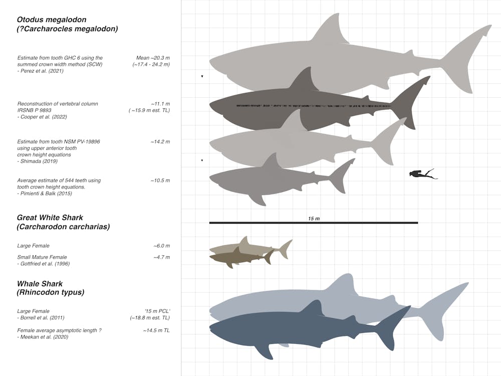
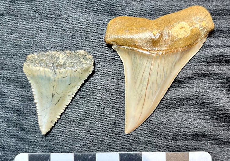
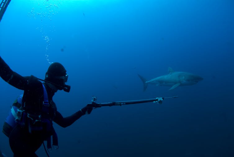


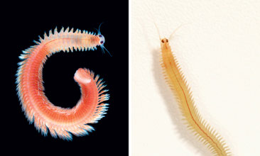
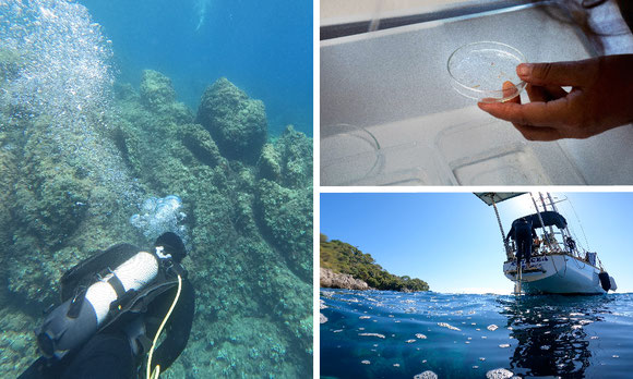

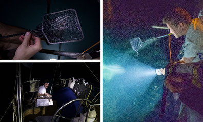


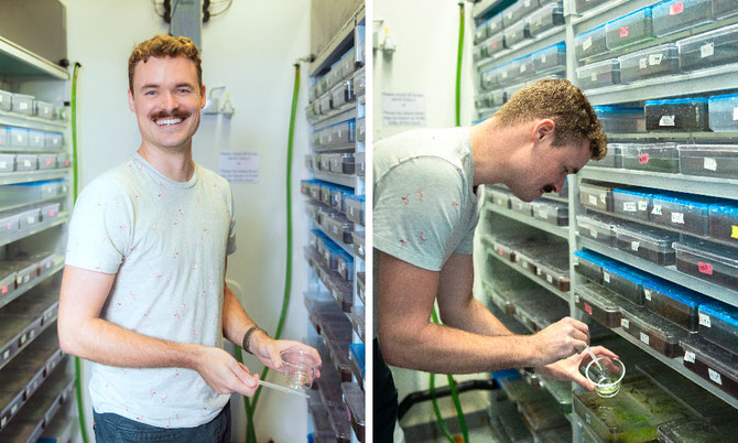


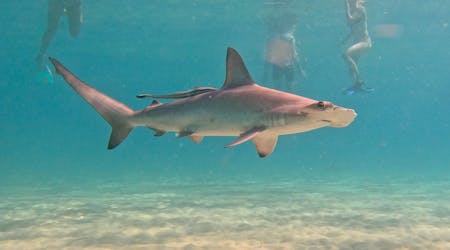
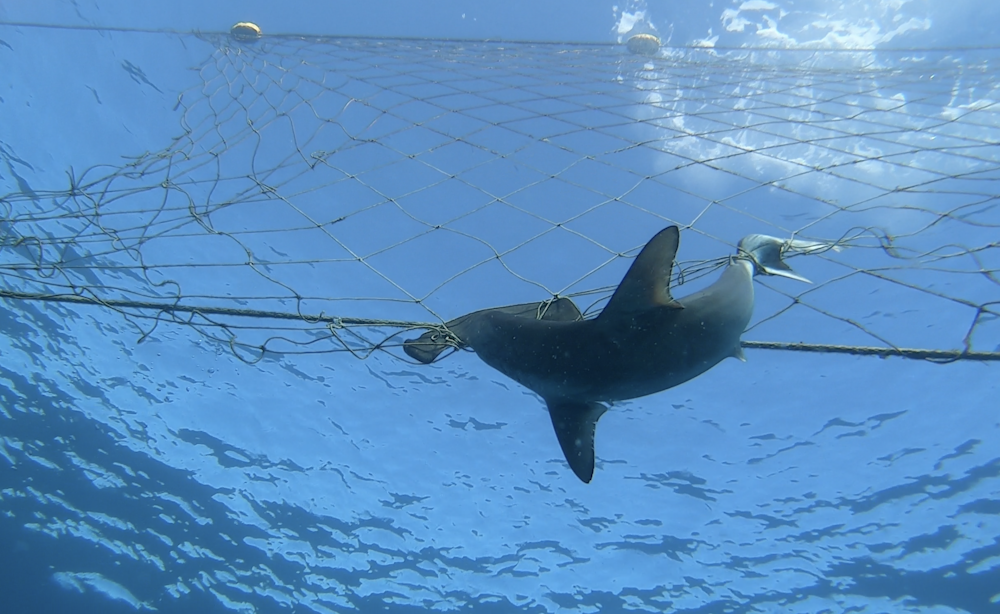


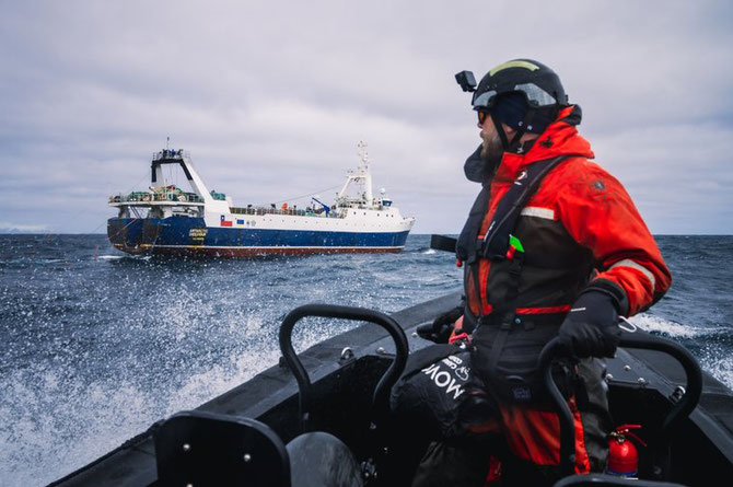
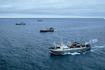
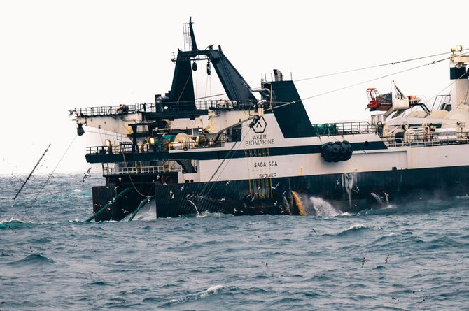
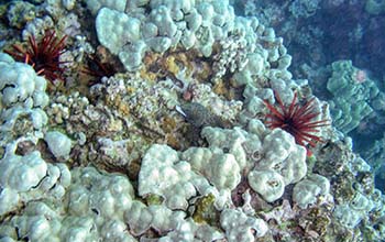


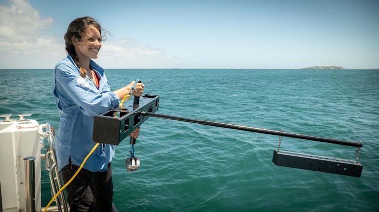
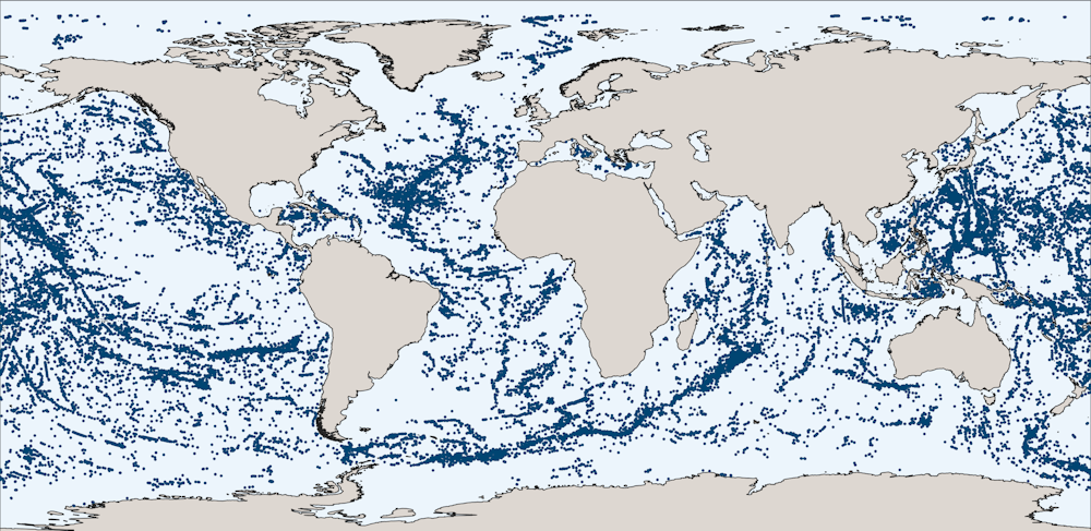

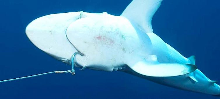

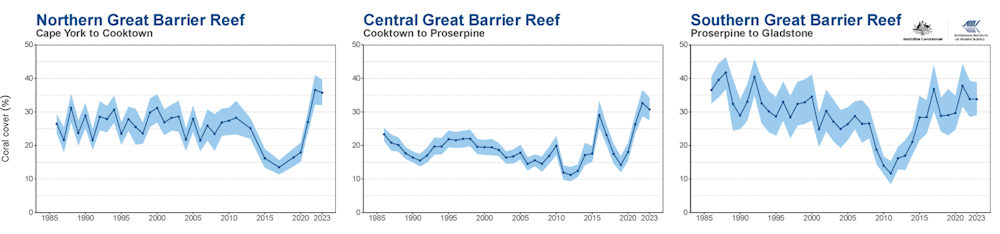
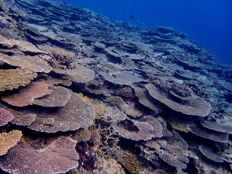
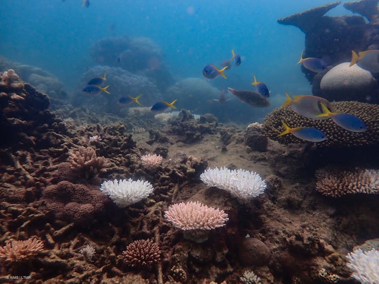
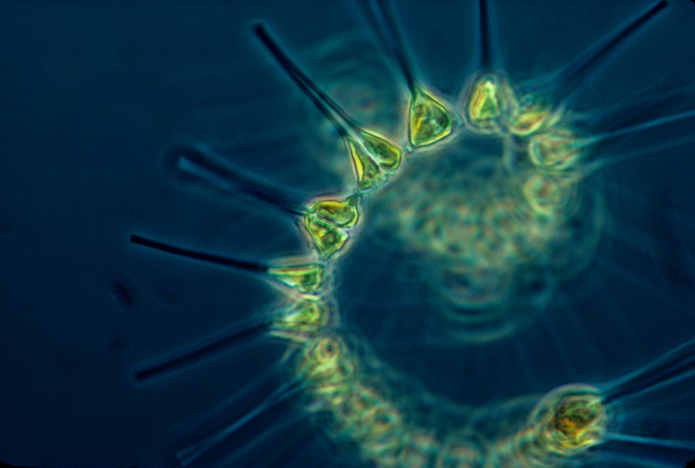
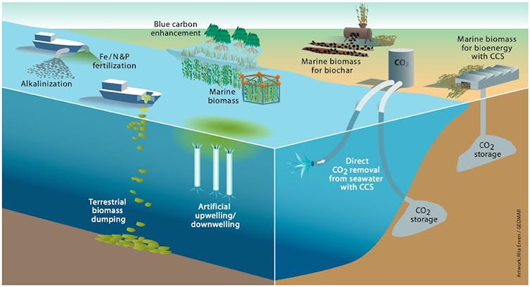


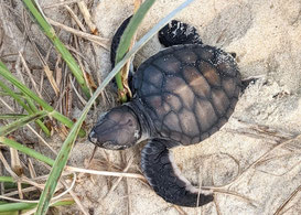
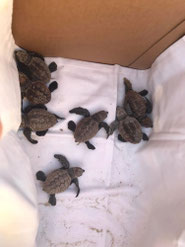
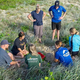
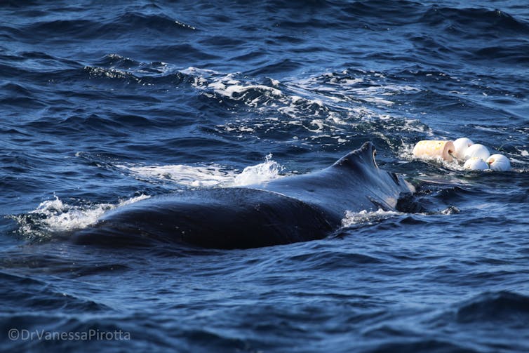
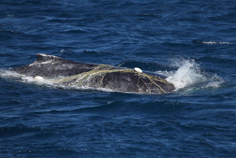
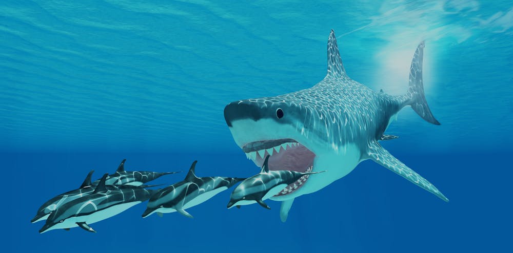
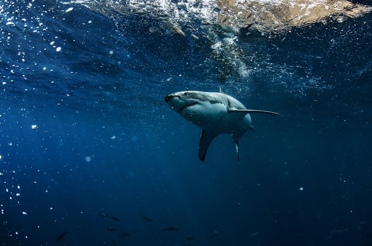
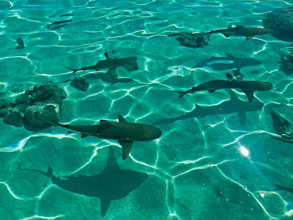


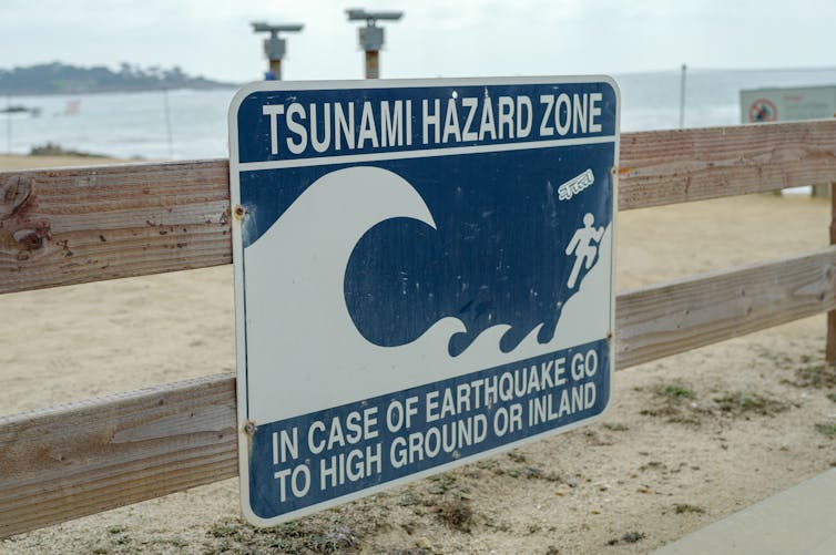

 Valerio Micaroni

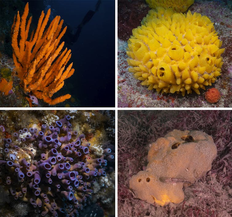

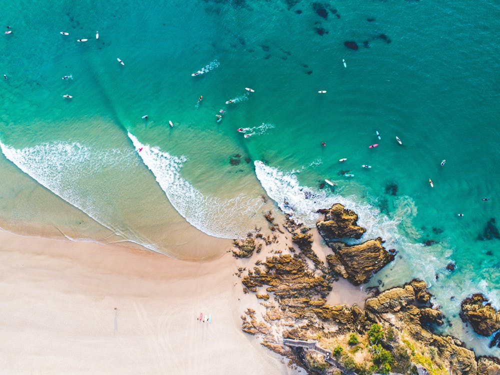
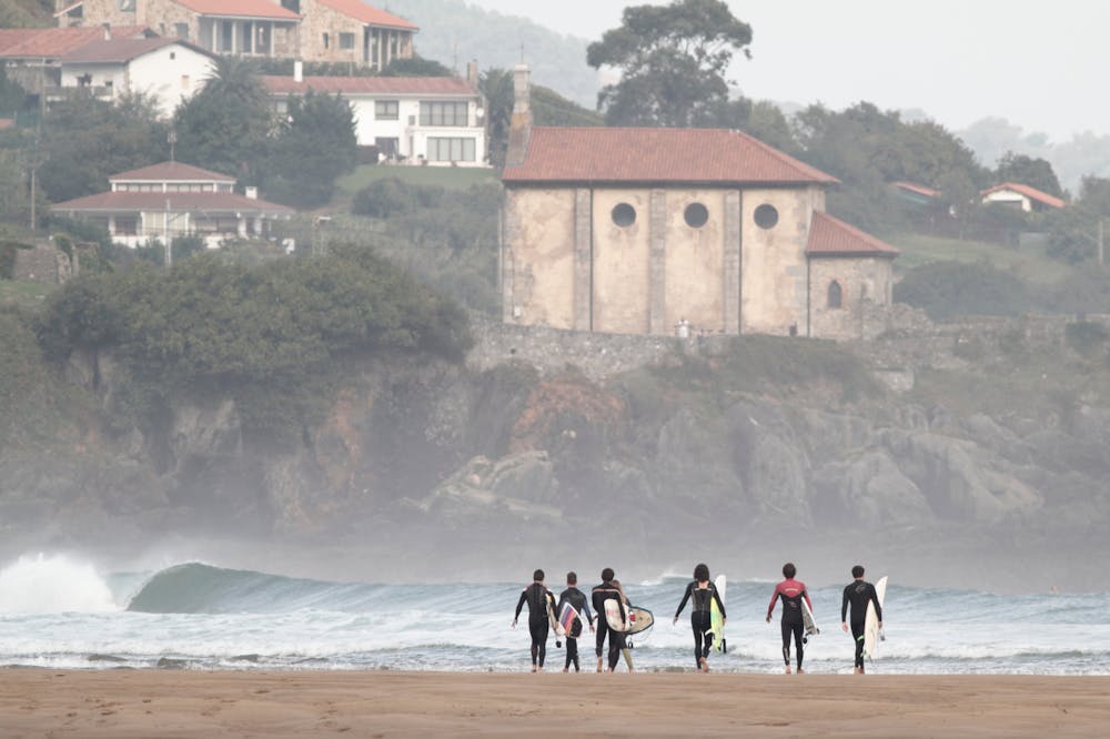
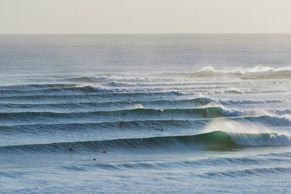